Area Overview for BN11 1NU
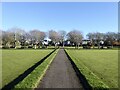
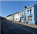
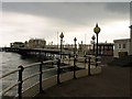
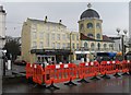
Photos of BN11 1NU
Area Information
Living in BN11 1NU means residing within a specific postcode cluster in the Central Ward of Worthing, South West Sussex. This small residential area spans just 873 square metres and supports a population of 1,207 people. The location sits firmly within the Worthing West parliamentary constituency, offering a distinct position within the broader coastal town. You are situated in an established urban ward where the density of housing creates an intimate community feel despite the proximity to wider city infrastructure. The area represents a slice of life in Worthing, balancing the convenience of town living with the specific constraints of a tightly clustered postcode. Residents here enjoy immediate access to major transport links, including Worthing Railway Station and Shoreham Airport, which define the practical reality of daily life in this neighbourhood. The compact size of the area ensures that facilities are within walking distance for many. As part of the Central Ward, BN11 1NU benefits from the wider amenities of Worthing while maintaining a focused residential character. The demographic profile suggests a community of adults, predominantly aged between 30 and 64, making it a home for working professionals and families. Understanding this specific cluster is essential for anyone deciding on homes in this section of Worthing.
- Area Type
- Postcode
- Area Size
- 873 m²
- Population
- Not available
- Population Density
- Not available
The property market in BN11 1NU is characterised by a mix of rental demand and a modest number of owner-occupiers. Only 32% of residents own their homes, indicating that nearly two-thirds of the population rents. This ratio makes the area potentially attractive to landlords looking for long-term tenants who are likely in the 30 to 64 age bracket. The accommodation stock is dominated by flats, a configuration that maximises value within the limited 873 square metre footprint of the postcode. Historical data from the Central Ward reveals an average new-build sale price of £277,032, placing the area in the mid-range for Worthing wards. The average price per square metre was £3,767 between 2017 and 2020. These figures suggest a practical market value that does not command the premium prices of the most exclusive Sussex locations. Because the area consists primarily of flats in a dense cluster, buyers should expect a high-quality urban living experience rather than spacious garden properties. The market reflects a typical established urban ward where convenience and location drive value more than plot size.
House Prices in BN11 1NU
Showing 12 properties
Energy Efficiency in BN11 1NU
Your daily life in BN11 1NU is enriched by a compact network of retail and transport facilities that are all within practical reach. You have five retail options immediately available, led by Waitrose Worthing, Tesco Worthing, and Iceland Worthing. These supermarkets provide everything from fresh produce to household essentials without the need for long-range driving. Shopping trips are quick and convenient, fitting seamlessly into a busy workday. Transport links further enhance your lifestyle with five nearby rail stations and two airports accessible within a short distance. The presence of Worthing Railway Station, East Worthing Railway Station, and West Worthing Railway Station means easy access to Crawley, London, and the rest of the South East. For leisure or travel, Shoreham Airport and Shoreham Brighton City Airport offer private and commercial flight options. This proximity to major commercial and lifestyle hubs defines the convenience of living in this ward. The area serves as a residential base with the entire convenience of Worthing at your doorstep, allowing you to enjoy a city lifestyle without the commute compromises of living further inland.
Amenities
Schools
| Rank | School | Type | Entry gender | Ages |
|---|
Explore more schools in this area
Go to Schools tabDemographics
The community in BN11 1NU is defined by a mature population structure. The median age for residents is 47 years, with the most common age range falling between 30 and 64 years. This concentration of adults suggests a neighbourhood suited to established households rather than young families or retirees. With 32% of residents owning their homes, there is a significant rental component within the skyline of this postcode. The remainder of the population rents, reflecting the mix of permanent buyers and those seeking temporary accommodations. The area is predominantly inhabited by individuals of White ethnicity, mirroring the broader demographic trends of the local authority. The accommodation type in BN11 1NU is overwhelmingly flats. This architectural choice aligns with the land constraints of a density-focused urban ward. You will find fewer detached or semi-detached houses compared to rural parts of Worthing. The high population density, calculated at 1,382,261 people per square kilometre based on the area size, indicates a vertically or tightly packed living arrangement. This demographic profile creates a dynamic environment where neighbours are likely to be working-age adults commuting to jobs in the region. The lack of child-specific age ranges in the primary population data suggests this is not a catchment for primary schools, but rather a zone for commuters and long-term residents.
Household Size
Accommodation Type
Tenure
Ethnic Group
Religion
Household Composition
Age
Household Deprivation
NS-SEC
Explore more demographic insights in this area
Go to Demographics tabPlanning
Planning Constraints
- Flood RiskPremium
- Ramsar Wetland SitesPremium
- Area of Outstanding Natural BeautyPremium
- Protected Nature ReservePremium
- Protected WoodlandPremium