Area Overview for BN11 1AQ
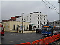
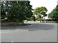
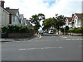
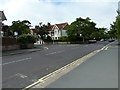
Photos of BN11 1AQ
Area Information
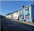
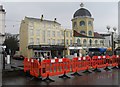
Living in BN11 1AQ means residing within a very small residential cluster defined by postcode BN11 1AQ in the Worthing Borough Council. This specific location occupies just 2,736 square metres and holds a population of 1,207 residents. The area sits within the Central Ward, an electoral division in the West Sussex district of the South East English Region. This ward forms part of the Worthing West parliamentary constituency and serves as the town of Worthing, a coastal settlement on the south coast of England. You are stepping into a compact urban environment where every building is close to another. The density of this postcode creates an immediate sense of proximity to the town centre facilities. While the total land area is minimal, it connects you directly to the wider amenities of the borough. You will find yourself in a setting that blends residential living with the immediate reach of major transport hubs and retail outlets. This specific postcode area covers a small residential cluster that prioritises access over expansive green space. Your daily life here revolves around the convenience of being situated right in the heart of the action.
- Area Type
- Postcode
- Area Size
- 2736 m²
- Population
- Not available
- Population Density
- Not available
Homes in BN11 1AQ are primarily flats, which defines the character of the housing stock in this specific postcode. The average new-build sale price in the surrounding Central Ward is £277,032, with an average price per square metre of £3,767. This positioning places the area in the mid-range for Worthing's wards by property values. A mixed residential character typical of an established urban ward suggests a variety of building ages and styles. With only 32 per cent home ownership in BN11 1AQ, the rental market remains strong alongside owner-occupied units. You will find that buying a home here involves navigating a competitive environment where flats are the standard product. The data from 2017–2020 indicates that buyers in this central ward are paying a premium for proximity to services. When you look at the typical flat in this postcode, you are purchasing a modern, compact living space. The market reflects a practical approach to city living where space is traded for location within Worthing.
House Prices in BN11 1AQ
Showing 3 properties
| Address | Type | Beds | Baths | Last Sale Price | Last Sale Date | |
|---|---|---|---|---|---|---|
| 34A High Street, Worthing Central, Worthing, BN11 1AQ | Flat | - | - | - | - | |
| Flat 1, 30 High Street, Worthing Central, Worthing, BN11 1AQ | Maisonette | - | - | - | - | |
| Flat 2, 30 High Street, Worthing Central, Worthing, BN11 1AQ | Flat | 1 | 1 | - | - |
Energy Efficiency in BN11 1AQ
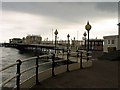
The lifestyle in BN11 1AQ is driven by immediate access to major retail and transport hubs. Residents have Waitrose Worthing, Tesco Worthing, and Lidl Central within practical reach for your daily shopping needs. You can choose from these specific venues based on your preferred brand or price point. Transport links are excellent, with Worthing Railway Station, East Worthing Railway Station, and West Worthing Railway Station located nearby. This gives you three distinct rail options without needing to travel far. You also have Shoreham Airport and Shoreham Brighton City Airport close at hand for air travel. Living in BN11 1AQ puts you minutes away from five different railway stations and two airports. The density of these amenities means you never need to plan a long journey for routine tasks. Your day trips to the coast or the city centre begin right from your doorstep.
Amenities
Schools
| Rank | School | Type | Entry gender | Ages |
|---|
Explore more schools in this area
Go to Schools tabDemographics
The community in BN11 1AQ reflects the profile of the Central Ward, which has an approximate population of 2,123. The median age for residents here is 47 years, confirming that adults aged 30 to 64 years are the most common age range. You should expect a neighbourhood dominated by mature working-age individuals rather than families with very young children or empty nesters moving into smaller spaces. Home ownership stands at 32 per cent, meaning a significant portion of people living in BN11 1AQ rent rather than own their property. The predominant form of accommodation in this postcode is flats, which aligns with the urban, compact nature of the 2,736 square metre site. The most predominant ethnic group in the local area is White. With such a high level of home ownership at 32 per cent and a stable age demographic, the area feels established. The lower rate of home ownership suggests a mix of long-term tenants and shorter-term lease holders. You are joining a community where the demographic stability of the 30-64 age bracket shapes the local culture and interactions.
Household Size
Accommodation Type
Tenure
Ethnic Group
Religion
Household Composition
Age
Household Deprivation
NS-SEC
Explore more demographic insights in this area
Go to Demographics tabPlanning
Planning Constraints
- Flood RiskPremium
- Ramsar Wetland SitesPremium
- Area of Outstanding Natural BeautyPremium
- Protected Nature ReservePremium
- Protected WoodlandPremium