Area Overview for BN11 1LU
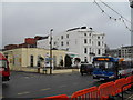
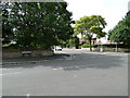
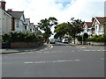
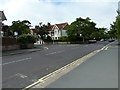
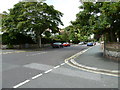
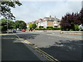
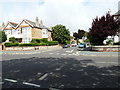
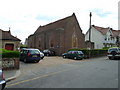
Photos of BN11 1LU
Area Information
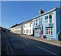
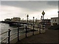
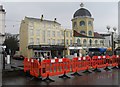
BN11 1LU is a small residential postcode area in Worthing, West Sussex, with a population of just 1,207 people. It lies within the Central Ward, part of the Worthing West parliamentary constituency, and reflects the character of an established coastal town. The area is compact, with a focus on residential living, and its proximity to Worthing’s town centre offers easy access to urban amenities. As a small cluster of homes, it balances quiet living with connectivity to nearby services. The demographic profile suggests a mature community, with a median age of 47 and most residents aged between 30 and 64. This makes it a stable, low-turnover area where many residents may have lived for years. The presence of multiple railway stations and retail outlets nearby indicates that daily life here is convenient for commuters and shoppers. While the area is not large, its integration with Worthing’s infrastructure means residents can enjoy coastal living without sacrificing accessibility to essential services.
- Area Type
- Postcode
- Area Size
- Not available
- Population
- Not available
- Population Density
- Not available
The property market in BN11 1LU is shaped by its small size and the prevalence of flats. With only 32% of homes owned by residents, the area leans heavily towards rental properties, suggesting a market more suited to tenants than buyers seeking long-term ownership. The dominance of flats indicates a compact, possibly older housing stock, typical of established urban areas. This contrasts with newer developments in nearby parts of Worthing, which may offer larger homes. For buyers, the limited number of owner-occupied properties means competition for available homes could be high. The average new-build sale price in the wider Central Ward was £277,032 between 2017 and 2020, placing it in the mid-range for the area. However, this data does not reflect current prices, so buyers should consider recent market trends. The small scale of BN11 1LU means its immediate surroundings, such as nearby wards, may offer more varied options.
House Prices in BN11 1LU
No properties found in this postcode.
Energy Efficiency in BN11 1LU
Living in BN11 1LU offers access to a range of local amenities within easy reach. The area is close to major retail outlets such as Waitrose Worthing, Lidl Central, and Tesco Worthing, ensuring residents have access to grocery shopping, dining, and other retail services. Multiple railway stations—Worthing, East Worthing, and West Worthing—make commuting straightforward, while nearby airports provide additional travel options. Although specific parks or leisure facilities are not listed, the proximity to Worthing’s town centre suggests access to coastal walks, cafes, and cultural attractions. The presence of five retail outlets and five rail stations within practical reach indicates a convenient, well-connected lifestyle. For residents, this means daily errands and travel are efficiently managed, supporting both urban and semi-rural living.
Amenities
Schools
| Rank | School | Type | Entry gender | Ages |
|---|
Explore more schools in this area
Go to Schools tabDemographics
The population of BN11 1LU is 1,207, with a median age of 47, reflecting a community dominated by adults aged 30 to 64. Home ownership here is relatively low, at 32%, suggesting a higher proportion of rental properties. The predominant accommodation type is flats, which aligns with the area’s residential density. The ethnic composition is overwhelmingly White, with no specific data provided on minority groups. This demographic profile indicates a settled, middle-aged population, likely with established careers and families. The low home ownership rate may imply a transient element, though the age range suggests stability. For prospective buyers, this means the market is more rental-focused, with fewer long-term owner-occupied properties. The absence of detailed diversity data means the community’s social composition remains largely uncharacterised beyond the dominant group.
Household Size
Accommodation Type
Tenure
Ethnic Group
Religion
Household Composition
Age
Household Deprivation
NS-SEC
Explore more demographic insights in this area
Go to Demographics tabPlanning
Planning Constraints
- Flood RiskPremium
- Ramsar Wetland SitesPremium
- Area of Outstanding Natural BeautyPremium
- Protected Nature ReservePremium
- Protected WoodlandPremium