Area Overview for BN1 9RH
Photos of BN1 9RH
Area Information
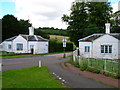
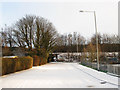
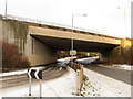
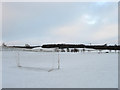
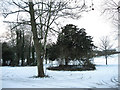
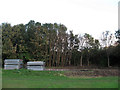
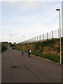
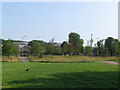
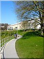
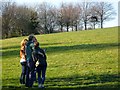
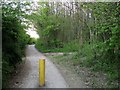
BN1 9RH lies in the Coldean area of Brighton and Hove, a low-density suburban district characterised by semi-detached housing built on a steep valley. With a population of 4,165 spread over 7,234 square metres, this small postcode area feels intimate yet connected to the city’s broader networks. Originally developed as postwar council housing from 1950, the area now features a mix of owner-occupied homes, reflecting its current 53% home ownership rate. The community is young, with a median age of 22 and the majority of residents aged 15–29. Daily life here balances quiet suburban living with proximity to Brighton’s amenities, including Stanmer Park, historic farm buildings, and nearby railway stations. The area’s steep wooded surroundings create a sense of seclusion, while its location near the A27 and Lewes Road ensures easy access to the city. For buyers, BN1 9RH offers a blend of practicality and charm, ideal for those seeking a peaceful yet connected lifestyle.
- Area Type
- Postcode
- Area Size
- 7234 m²
- Population
- 4165
- Population Density
- 1271 people/km²
BN1 9RH is primarily a housing area with semi-detached properties forming the bulk of its accommodation stock. With 53% home ownership, the market reflects a balance between owner-occupied and rental properties, though the small size of the postcode suggests limited housing stock. The area’s low-density layout, with homes built along the valley’s natural shape, creates a quiet, suburban feel. For buyers, this means a focus on individual properties rather than high-rise or shared housing. Proximity to Brighton’s amenities and transport links may make it attractive to those seeking a compromise between city access and residential tranquillity. However, the limited size of the area means competition for properties could be keen, particularly for homes near key routes like the A27 or railway stations.
House Prices in BN1 9RH
Showing 2 properties
| Address | Type | Beds | Baths | Last Sale Price | Last Sale Date | |
|---|---|---|---|---|---|---|
| Meeting House, Southern Ring Road, University Of Sussex, Brighton, BN1 9RH | commercial | - | - | - | - | |
| Sussex House, Southern Ring Road, University Of Sussex, Brighton, BN1 9RH | retail_financial | - | - | - | - |
Energy Efficiency in BN1 9RH
BN1 9RH’s lifestyle is shaped by its proximity to retail, green spaces, and transport hubs. Nearby shops include The Southern Co-operative Co, Asda Brighton, and M&S Carden Av Brighton, offering everyday essentials. The area’s character is defined by its low-density, garden suburb layout, with access to Stanmer Park and historic farm buildings like Coldean Farm. A branch library on Beatty Avenue and Varley Halls student accommodation add to the mix. The quiet, wooded surroundings contrast with the convenience of nearby roads and railways, making it ideal for those seeking a balance between seclusion and city access. For residents, daily life blends suburban tranquillity with practical connectivity to Brighton’s wider amenities.
Amenities
Schools
The nearest notable educational institution to BN1 9RH is the University of Sussex, though it is categorised as an “other” type in the data and no Ofsted rating is provided. No primary or secondary schools are listed within the area, which may require families to seek options in nearby districts like Stanmer or Falmer. The absence of local schools suggests that residents may rely on nearby towns or transport links to access education for children. For those prioritising proximity to academic institutions, the University of Sussex’s presence could be a draw, though it does not cater to younger students. Families with children may need to evaluate the practicality of commuting to schools outside BN1 9RH.
| Rank | School | Type | Entry gender | Ages |
|---|
Explore more schools in this area
Go to Schools tabDemographics
BN1 9RH has a median age of 22, with 53% of residents owning their homes. The area’s population of 4,165 is dominated by young adults aged 15–29, reflecting a dynamic, possibly student or early-career demographic. Home ownership is moderate, suggesting a mix of renters and buyers, though the predominant accommodation type is houses—specifically semi-detached properties built to follow the valley’s contours. The predominant ethnic group is White, though no specific diversity statistics are provided. The low population density of 1,271 people per square kilometre indicates a spread-out, suburban layout. For quality of life, the young age profile may mean a lively social scene, but the lack of detailed diversity data means the community’s full composition remains unclear.
Household Size
Accommodation Type
Tenure
Ethnic Group
Religion
Household Composition
Age
Household Deprivation
NS-SEC
Explore more demographic insights in this area
Go to Demographics tabPlanning
Planning Constraints
- Flood RiskPremium
- Ramsar Wetland SitesPremium
- Area of Outstanding Natural BeautyPremium
- Protected Nature ReservePremium
- Protected WoodlandPremium