Area Overview for BN1 9QF
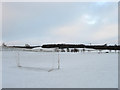
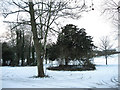
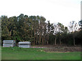
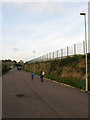
Photos of BN1 9QF
Area Information
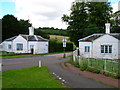
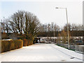
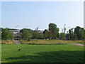
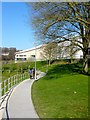
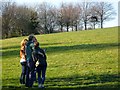
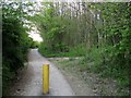
BN1 9QF lies in Coldean, a quiet suburban area on Brighton and Hove’s northern edge. This small postcode covers just 1.3 hectares, housing 4,165 residents in a low-density, garden-style layout. Originally developed as postwar council housing from 1950, the area now features semi-detached homes with steep wooded surroundings, creating a secluded feel. The population density of 1,271 people per square kilometre reflects a compact, close-knit community. Proximity to Stanmer Park and the historic Stanmer village adds green space and charm. Coldean’s character is defined by its isolation from Brighton’s urban core, with winding roads and a mix of older housing stock. Young adults dominate, with a median age of 22, suggesting a dynamic, student-influenced demographic. The area’s blend of residential tranquillity and access to nearby amenities like the University of Sussex makes it appealing for those seeking a balance between suburban calm and urban connectivity.
- Area Type
- Postcode
- Area Size
- 1.3 hectares
- Population
- 4165
- Population Density
- 1271 people/km²
BN1 9QF is predominantly owner-occupied, with 53% of homes owned by residents. The accommodation type is largely houses, reflecting a semi-detached, low-density layout typical of postwar council estates. This contrasts with areas dominated by flats or rental properties, suggesting a focus on family homes and long-term residency. The small area size (1.3 hectares) means housing stock is limited, potentially increasing competition for buyers. The proximity to Stanmer village and Brighton’s amenities may enhance property value, though the lack of major transport hubs nearby could be a consideration. For buyers, the mix of older housing and limited new developments may appeal to those seeking characterful homes with garden space. However, the absence of high-density housing means rental options are likely scarce, making this a less attractive area for investors seeking short-term returns.
House Prices in BN1 9QF
Showing 2 properties
| Address | Type | Beds | Baths | Last Sale Price | Last Sale Date | |
|---|---|---|---|---|---|---|
| Students Union Shop, Falmer House, Gardner Centre Road, University Of Sussex, Brighton, BN1 9QF | shop | - | - | - | - | |
| Mandela Hall, Gardner Centre Road, University Of Sussex, Brighton, BN1 9QF | retail_financial | - | - | - | - |
Energy Efficiency in BN1 9QF
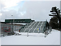
BN1 9QF’s lifestyle is shaped by its proximity to Stanmer Park, a large green space offering walking, cycling, and recreational opportunities. Nearby, the Southern Co-operative Co, Asda Brighton, and M&S Carden Av provide essential retail and dining options. The area’s semi-detached housing and wooded surroundings foster a quiet, suburban atmosphere, distinct from Brighton’s busier districts. While no specific restaurants or leisure venues are listed, the nearby Stanmer village likely offers additional amenities. The character of Coldean, with its historic roots and postwar development, blends practicality with a sense of community. Residents can enjoy the tranquillity of the valley while accessing Brighton’s cultural and commercial hubs via rail or road, making it appealing to those seeking a balance between nature and urban convenience.
Amenities
Schools
The only named school near BN1 9QF is the University of Sussex, categorised as an “other” institution. No primary or secondary schools are listed in the data, which may be a concern for families requiring local education. The absence of nearby schools suggests that residents must travel to Stanmer or Brighton for schooling, potentially impacting convenience. The University of Sussex’s presence indicates a student population influence, though it does not serve as a primary or secondary school. For families, this highlights the need to assess commuting distances and availability of alternative educational options in the wider area. The lack of specific school ratings or types in the data means further local research is necessary to evaluate educational quality.
| Rank | School | Type | Entry gender | Ages |
|---|
Explore more schools in this area
Go to Schools tabDemographics
BN1 9QF has a median age of 22, with the majority of residents aged 15–29. This young adult demographic shapes the area’s energy, likely influenced by nearby educational institutions. Home ownership sits at 53%, with houses being the predominant accommodation type. This suggests a mix of long-term residents and those prioritising property investment. The White ethnic group forms the largest share of the population, though specific diversity figures are not provided. The high population density of 1,271 people per square kilometre indicates a compact, community-focused environment. While no deprivation data is available, the low crime risk (score 82) and absence of planning constraints suggest a stable, low-stress living environment. The age profile and ownership rates imply a balance between student populations and families, though the lack of childcare facilities or primary schools might affect family-oriented buyers.
Household Size
Accommodation Type
Tenure
Ethnic Group
Religion
Household Composition
Age
Household Deprivation
NS-SEC
Explore more demographic insights in this area
Go to Demographics tabPlanning
Planning Constraints
- Flood RiskPremium
- Ramsar Wetland SitesPremium
- Area of Outstanding Natural BeautyPremium
- Protected Nature ReservePremium
- Protected WoodlandPremium