Area Overview for BN1 9PX
Photos of BN1 9PX
Area Information
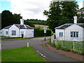
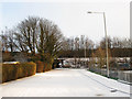
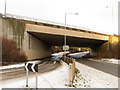
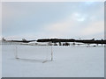
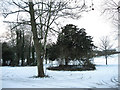
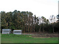
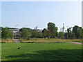
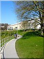
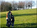
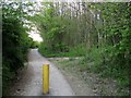
BN1 9PX is a small residential cluster nestled in the Coldean area of Brighton and Hove, occupying a steep valley on the historic boundary of Stanmer parish. With a population of 4,165 and a compact area of 3,560 square metres, this postcode reflects a postwar housing development initiated by Brighton Corporation in 1950 to address shortages. The area’s low-density layout, characterised by semi-detached homes, creates a quiet, isolated feel, bordered by wooded slopes that separate it from the rest of Brighton. Its proximity to Stanmer Park, historic farm buildings, and the converted flint barn of St Mary Magdalene’s Church adds a layer of local heritage. Residents benefit from nearby rail links, including Falmer and Moulsecoomb stations, and the A27 trunk road provides quick access to the city. This blend of suburban tranquillity and connectivity makes BN1 9PX a distinctive choice for those seeking a balance between seclusion and urban accessibility.
- Area Type
- Postcode
- Area Size
- 3560 m²
- Population
- 4165
- Population Density
- 1271 people/km²
The property market in BN1 9PX is shaped by its history as a postwar council estate, with semi-detached houses forming the majority of the housing stock. Home ownership stands at 53%, indicating a balance between owner-occupied properties and rental units. The area’s compact size and low-density layout mean that properties are likely to be spread across the valley, with limited high-rise development. Buyers should consider that the market may cater more to first-time buyers or those seeking affordable housing in a suburban setting. The presence of nearby student accommodation, such as Varley Halls at the University of Brighton, suggests that some properties may be rented out to students, though this is not explicitly stated in the data. For those prioritising stability, the low crime risk and proximity to transport links could make BN1 9PX an attractive option, despite its small size and limited expansion potential.
House Prices in BN1 9PX
Showing 1 properties
| Address | Type | Beds | Baths | Last Sale Price | Last Sale Date | |
|---|---|---|---|---|---|---|
| Medical School, Biology Road, University Of Sussex, Brighton, BN1 9PX | commercial | - | - | - | - |
Energy Efficiency in BN1 9PX
BN1 9PX offers a mix of retail and leisure options within practical reach. Nearby shops include The Southern Co-operative Co, Asda Brighton, and Morrisons Daily, providing essential grocery and retail services. The area’s proximity to Stanmer Park, a historic public space, offers opportunities for outdoor activities, walks, and family recreation. The converted flint barn of St Mary Magdalene’s Church and Varley Halls student accommodation add cultural and social layers to the community. Local amenities such as a branch library on Beatty Avenue and a junior school on Selham Drive (as noted in areaResearch) contribute to a sense of community. While the area is small, its connection to Brighton’s broader infrastructure means residents can access the city’s dining, entertainment, and cultural offerings with ease, balancing suburban comfort with urban convenience.
Amenities
Schools
The only named educational institution near BN1 9PX is the University of Sussex, categorised as an ‘other’ type in the data. No primary or secondary schools are explicitly listed, though the areaResearch mentions a junior school on Selham Drive. This absence of detailed school data means families may need to look beyond the immediate postcode for educational options. The proximity to the University of Sussex suggests a student demographic, but the lack of local schools for younger children could be a consideration for families. Residents may need to rely on nearby wards or transport links to access schools in Coldean, Falmer, or Stanmer. The mix of higher education and limited local schooling highlights the area’s role as a satellite to broader educational hubs rather than a standalone community for families.
| Rank | School | Type | Entry gender | Ages |
|---|
Explore more schools in this area
Go to Schools tabDemographics
BN1 9PX has a median age of 22, with the majority of residents falling into the 15–29 age range. This young demographic is reflected in the area’s 53% home ownership rate, suggesting a mix of first-time buyers and long-term residents. The predominant accommodation type is houses, which aligns with the semi-detached housing stock typical of postwar developments. The area’s population density of 1,271 people per square kilometre indicates a compact, closely knit community. The predominant ethnic group is White, though no specific data on diversity or deprivation levels is provided. The age profile suggests a focus on young professionals, students, or families with children, though the absence of detailed school data means this remains speculative. The relatively low median age also implies a dynamic, evolving community with potential for growth and change.
Household Size
Accommodation Type
Tenure
Ethnic Group
Religion
Household Composition
Age
Household Deprivation
NS-SEC
Explore more demographic insights in this area
Go to Demographics tabPlanning
Planning Constraints
- Flood RiskPremium
- Ramsar Wetland SitesPremium
- Area of Outstanding Natural BeautyPremium
- Protected Nature ReservePremium
- Protected WoodlandPremium