Area Overview for BN1 9PS
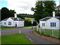
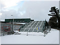
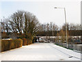
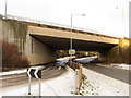
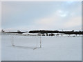
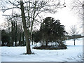
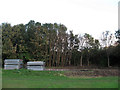
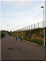
Photos of BN1 9PS
Area Information
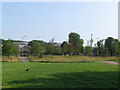
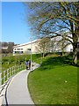
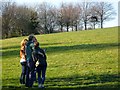
BN1 9PS lies in Coldean, a low-density suburb in Brighton and Hove, England. This small postcode area covers 9,863 square metres and is home to 4,165 people, with a population density of 1,271 per square kilometre. The area was developed as a postwar council estate from 1950, addressing housing shortages, and now features semi-detached homes that follow the valley’s contours. Its steep wooded sides create a quiet, isolated feel, distinct from Brighton’s bustling urban core. Nearby, Stanmer Park and the village of Stanmer offer green space and historical charm. The area’s proximity to the A27 trunk road and multiple railway stations ensures connectivity to Brighton’s amenities, while its compact size fosters a tight-knit community. With a median age of 22 and a population skewed toward young adults, BN1 9PS reflects a dynamic, student-friendly environment. The presence of the University of Sussex nearby adds to its academic vibe, though the area itself remains focused on residential living.
- Area Type
- Postcode
- Area Size
- 9863 m²
- Population
- 4165
- Population Density
- 1271 people/km²
The property market in BN1 9PS is dominated by houses, with 53% of homes owner-occupied. This suggests a stable, long-term resident base, though the area’s small size means the housing stock is limited. The semi-detached nature of the properties, shaped by the valley’s topography, offers private gardens and space, appealing to families or those seeking a quieter lifestyle. However, the relatively low home ownership rate (47%) indicates a significant rental market, which could affect property values and availability. Buyers should consider the area’s compact footprint and its integration with Brighton’s broader housing market. Proximity to Stanmer Park and the A27 may enhance desirability, but the lack of protected or constrained land (no AONB, Ramsar sites, or nature reserves) means development pressures are minimal.
House Prices in BN1 9PS
Showing 1 properties
| Address | Type | Beds | Baths | Last Sale Price | Last Sale Date | |
|---|---|---|---|---|---|---|
| Medical Research Centre, Biology Road, University Of Sussex, Brighton, BN1 9PS | commercial | - | - | - | - |
Energy Efficiency in BN1 9PS
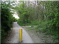
BN1 9PS offers a mix of retail and leisure options within practical reach. The Southern Co-operative Co, Asda Brighton, and Morrisons Daily provide essential shopping, while the area’s proximity to Stanmer Park offers recreational space for walking, cycling, or picnics. The valley’s wooded sides contribute to a tranquil environment, contrasting with Brighton’s urban energy. Nearby, the University of Sussex and Varley Halls add an academic and student-centric vibe. The area’s character is defined by its semi-detached housing and quiet, green surroundings, making it appealing to those seeking a relaxed lifestyle. However, the lack of listed cafes, restaurants, or cultural venues suggests a focus on residential comfort over vibrant nightlife. Residents may need to travel to Brighton for more extensive dining or entertainment options.
Amenities
Schools
The nearest educational institution to BN1 9PS is the University of Sussex, a higher education provider. No primary or secondary schools are listed in the data, which may require residents to seek options further afield. The absence of local schools could impact families prioritising proximity to education, though the area’s transport links—such as Falmer and Moulsecoomb railway stations—provide access to Brighton’s broader school network. The University of Sussex’s presence adds an academic atmosphere, potentially attracting students or professionals in related fields. However, without specific details on nearby schools, prospective buyers should investigate further to ensure alignment with their children’s educational needs.
| Rank | School | Type | Entry gender | Ages |
|---|
Explore more schools in this area
Go to Schools tabDemographics
BN1 9PS has a median age of 22, with the majority of residents aged 15–29. This young demographic is reflected in the 53% home ownership rate, suggesting a mix of owner-occupied properties and rental units. The area is predominantly composed of houses, which aligns with its low-density, suburban character. The predominant ethnic group is White, though specific data on diversity beyond this is not available. The population density of 1,271 per square kilometre indicates a moderately compact living environment, balancing private space with proximity to amenities. The high proportion of young adults implies a community centred around education, employment, or transient lifestyles. While no explicit data on deprivation is provided, the area’s infrastructure—such as nearby schools, retail, and transport links—suggests reasonable access to essential services.
Household Size
Accommodation Type
Tenure
Ethnic Group
Religion
Household Composition
Age
Household Deprivation
NS-SEC
Explore more demographic insights in this area
Go to Demographics tabPlanning
Planning Constraints
- Flood RiskPremium
- Ramsar Wetland SitesPremium
- Area of Outstanding Natural BeautyPremium
- Protected Nature ReservePremium
- Protected WoodlandPremium