Area Overview for Sandhurst (Bracknell Forest)
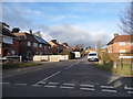
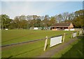
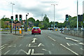
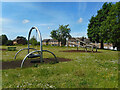
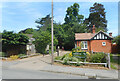
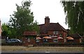
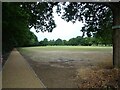
Photos of Sandhurst (Bracknell Forest)

Area Information
Sandhurst is a built-up area within Bracknell Forest, covering a geographical footprint of 5.0 km². With a population of 1,269 residents, the area maintains a population density of 252 people per square kilometre. This density creates a residential environment that is neither overwhelmingly dense nor sparsely populated. Living in Sandhurst offers a suburban character distinguished by its specific size and resident count. The area functions as a self-contained community, separate from the larger borough while remaining part of the Bracknell Forest administrative structure. Daily life here is defined by the balance between having a defined locality and accessing the wider network of services in the surrounding region. The physical dimensions of the area influence travel times and the proximity of neighbours, contributing to a specific sense of place. Prospective homebuyers should note that the area size directly impacts how spread out housing might be across the 5.0 km². The population figure of 1,269 indicates a small but substantial community that avoids the anonymity of larger urban centres. This demographic scale supports a grassroots social environment without the congestion typically associated with larger towns. The area represents a specific node within the Bracknell Forest landscape, offering residents a distinct profile for their property search. Understanding these foundational metrics provides clarity on what life entails within these boundaries.
- Area Type
- Built Up Area 250
- Area Size
- 5.0 km²
- Population
- 1269
- Population Density
- 252 people/km²
Residents of Sandhurst benefit from a practical range of amenities located within practical reach. Retail options are provided by five key venues, including Co-op Owlsmoor, Co-op Sandhurst, and a Tesco Sandhurst location. These supermarkets allow for convenient weekly shopping without the need to travel significant distances. For those requiring rail transport, there are five railway stations accessible to the area, including Sandhurst Railway Station, Blackwater Railway Station, and Crowthorne Railway Station. These stations offer connectivity to broader regional and national networks. Leisure interests can be supported by access to two airports, namely Blackbushe Airport and Farnborough Airport, which may appeal to aviation enthusiasts or frequent business travellers. The presence of these airports indicates that Sandhurst is situated transport hub strategically positioned for travel. The layout of amenities suggests a lifestyle focused on convenience and access rather than destination culture. Daily errands can be completed locally at the Co-op branches or the Tesco. The proximity of rail links ensures that work commutes or leisure trips from Sandhurst are manageable. This mix of retail and transport options defines the day-to-day convenience available to homeowners in the built-up area.
Amenities
Schools
Families choosing to live in Sandhurst have access to a range of primary educational institutions within the local vicinity. The nearest primary schools include College Town Primary School, which holds a good Ofsted rating, providing a secure option for younger children. Other local primaries include Uplands Primary School and Nursery and College Town Junior School, which cater to the early and middle years of compulsory education. Owlsmoor Primary School also operates in the area and carries a good Ofsted rating, reinforcing the presence of reputable education provision. Additionally, New Scotland Hill Primary School offers another choice with a good rating from inspectors. This concentration of schools with good ratings indicates a commitment to quality education by the local authority. The mix of schools listed suggests that families have several options nearby, though the diversity of school types is limited to primary provision in the immediate data set. Residents do not have immediate access to secondary schools listed in the provided information, meaning transport to further education might require travel to other towns. The presence of multiple primaries with good ratings is a positive factor for households prioritising educational standards within Sandhurst (Bracknell Forest). Prospective parents should investigate individual catchment areas and transport links in conjunction with this local school list.
| Rank | School | Type | Entry gender | Ages |
|---|
Explore more schools in this area
Go to Schools tabDemographics
The community profile in Sandhurst reveals a mature settlement with a median age of 70 years. This advanced demographic suggests that the area is populated predominantly by older individuals and families later in life. Home ownership stands at 77%, which is a significant proportion of the total households. This high rate indicates that a vast majority of residents own their homes outright or have substantial equity in their properties. Such levels of ownership are typical of areas designated for retirement or established older communities. The accommodation statistics reflect a stock built for long-term residency rather than transient living. There is a clear alignment between the age of the population and the stability of home ownership. When considering homes in Sandhurst, buyers must account for a demographic where life expectancy and tenure likely overlap significantly. The household composition data points towards stability, with few young families or transient workers forming the core of the population. This demographic reality shapes the local economy and social interactions, creating a neighbourhood where long-term neighbours are the norm. For anyone planning to live here, the social fabric is woven by people with decades of local experience. The 77% ownership rate provides a strong indicator of financial stability within the community.
Household Size
Accommodation Type
Tenure
Ethnic Group
Religion
Household Composition
Age
Household Deprivation
NS-SEC
Explore more demographic insights in this area
Go to Demographics tabPlanning
Planning Constraints
- Crime RiskPremium