Area Overview for Basingstoke and Deane District (B)
Photos of Basingstoke and Deane District (B)
Area Information
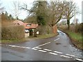
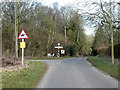
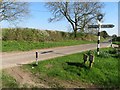
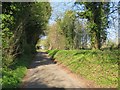
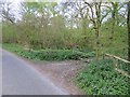
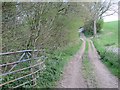
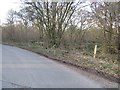
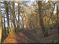
Basingstoke and Deane District covers an extensive 634.2 km² of landscape in South East England. This local authority district, formed in 1974, is anchored by the ancient market town of Basingstoke, a settlement recorded in the Domesday Book of 1086. Living in this area offers immediate access to significant historical sites, including Basing House, the ruins of England's largest Tudor residence, and the Willis Museum which preserves local artefacts. The district maintains a strong connection to its agricultural roots, evidenced by protected woodland areas that influence planning decisions. Meanwhile, the town centre thrives around a regular Wednesday market and the statue of Jane Austen in Market Place. You will find distinct transport links here, having benefited from the London and South Western Railway since 1839. This rail infrastructure provided connections to Reading and supported the town's evolution into a manufacturing hub during the 19th century. Today, Thomas Burberry started his business in Winchester Street in 1856, illustrating the long-standing commercial activity. The area includes the Basingstoke Canal, built in 1792 to connect the town to the River Thames. For residents, daily life blends proximity to these historic landmarks with the practicalities of a substantial local authority district. The geographical coordinates place the town centrally within Hampshire, ensuring accessibility via major road networks while preserving the peaceful countryside character.
- Area Type
- District/Borough
- Area Size
- 634.2 km²
- Population
- Not available
- Population Density
- Not available
Demographics
Living in Basingstoke and Deane District involves a community with a notably mature population profile. Recent data indicates a median age of 70 across the district. This demographic skew suggests that the area attracts retirees or families with older children. The community composition reflects a population where total age grouping remains the most common descriptor in available records. You can expect a largely settled neighbourhood where residents have remained in the area for significant periods. Home ownership is a defining feature of life in this district. A solid 67% of households own their homes outright or with a mortgage. This high rate of ownership typically creates a stable community environment where long-term residents influence local amenities and planning. The data does not specify a single predominant ethnic group or religious affiliation, indicating a diverse yet culturally blended populace. The district accommodates various household types, though specific breakdowns for single-person or multi-occupancy units are not detailed in the current records. Regardless of your family size, the high ownership rate means policy decisions often prioritise the needs of established homeowners.
Household Size
Accommodation Type
Tenure
Ethnic Group
Religion
Household Composition
Age
Household Deprivation
NS-SEC
Explore more demographic insights in this area
Go to Demographics tabPlanning
Planning Constraints
- Flood RiskPremium
- Ramsar Wetland SitesPremium
- Area of Outstanding Natural BeautyPremium
- Protected Nature ReservePremium
- Protected WoodlandPremium
- Crime RiskPremium