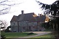
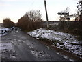
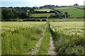
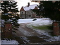
Area Overview for East Hampshire District
Photos of East Hampshire District

Area Information
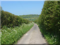
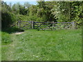
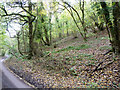
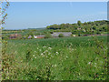
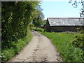
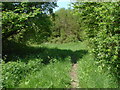
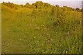
Living in East Hampshire District offers a very different experience compared to many popular urban communities. This local authority district covers a vast 514.7 km², creating a predominantly rural landscape rather than a dense town centre. You are not looking at a typical city neighbourhood here; instead, you are entering a spacious area defined by green spaces and a slower pace of life. The sheer size of the district means daily routines involve more travel time or reliance on your vehicle, as services are spread out across the territory. For those who prioritise space and nature over immediate urban convenience, the geography of East Hampshire District provides a distinct alternative. You will find that life here revolves around the land itself rather than high-rise developments or packed streets. This area caters specifically to individuals who value extensive open skies and quiet surroundings. The scale of the district ensures that you rarely feel the pressure of crowded public spaces. It is a place where the weekend involves exploration of the countryside rather than local shopping visits. The distinct character of East Hampshire District makes it suitable for buyers who have already sold their city centre aspirations and seek a permanent rural settlement. Your home life will be shaped by the borough unitary status that manages such a large and varied expanse of land.
- Area Type
- District/Borough
- Area Size
- 514.7 km²
- Population
- Not available
- Population Density
- Not available
Demographics
The community profile in East Hampshire District skews significantly older than the national average. Your neighbours here are likely to fit an average age of 70 years rather than a typical working-age demographic. Most residents fall into the older age bracket, which means the social energy of the area differs from youthful urban districts. You should expect a population where retirement and later life stages dominate the daily interactions. This age structure influences everything from local events to the availability of services that primarily target younger families. Home ownership stands at 74% within East Hampshire District, confirming that this is a settled area of established families and retirees rather than a transient rental market. The high ownership rate suggests long-term residents who have stayed through various life stages within this district. Accommodation types reflect this stability, though specific breakdowns of housing styles remain general in the available figures. You will not find the typical high-density student housing common in other boroughs. The demographic reality means that if you are considering schools near East Hampshire District, you are entering an area with a very specific family profile. The 70-year median age defines who lives here today. Every statistic from the 74% ownership rate to the median age tells you exactly who belongs in this community.
Household Size
Accommodation Type
Tenure
Ethnic Group
Religion
Household Composition
Age
Household Deprivation
NS-SEC
Explore more demographic insights in this area
Go to Demographics tabPlanning
Planning Constraints
- Flood RiskPremium
- Ramsar Wetland SitesPremium
- Protected Nature ReservePremium
- Protected WoodlandPremium
- Crime RiskPremium