Area Overview for WA11 0AY
Photos of WA11 0AY

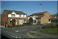


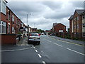


12 photos from this area
Area Information
Key information about the WA11 0AY including its size, population, and administrative classification.
- Area Type
- Postcode
- Area Size
- 8136 m²
- Population
- 1450
- Population Density
- 5740 people/km²
House Prices in WA11 0AY
45
Properties
£65,903
Average Sold Price
£22,000
Lowest Price
£104,950
Highest Price
Showing 45 properties
| Address | Type | Beds | Baths | Last Sale Price | Last Sale Date | |
|---|---|---|---|---|---|---|
| 382 West End Road, Haydock, St Helens, WA11 0AY | Terraced | 2 | 1 | £85,000 | Jul 2025 | |
| 354 West End Road, Haydock, St Helens, WA11 0AY | Terraced | 2 | 1 | £65,000 | Feb 2024 | |
| 392 West End Road, Haydock, St Helens, WA11 0AY | Terraced | 2 | - | £100,000 | Feb 2024 | |
| 342 West End Road, Haydock, St Helens, WA11 0AY | Terraced | 2 | 1 | £93,500 | Jul 2023 | |
| 320 West End Road, Haydock, St Helens, WA11 0AY | house | 2 | 1 | £65,000 | Feb 2023 | |
| 344 West End Road, Haydock, St Helens, WA11 0AY | Terraced | 3 | 1 | £90,000 | Jan 2023 | |
| 394 West End Road, Haydock, St Helens, WA11 0AY | Terraced | 2 | 1 | £80,000 | Aug 2020 | |
| 306 West End Road, Haydock, St Helens, WA11 0AY | Terraced | 3 | 1 | £65,000 | Jul 2020 | |
| 336 West End Road, Haydock, St Helens, WA11 0AY | Terraced | 2 | 1 | £56,000 | Apr 2020 | |
| 372 West End Road, Haydock, St Helens, WA11 0AY | Terraced | 2 | 1 | £82,000 | Mar 2020 |
Page 1 of 5
Energy Efficiency in WA11 0AY
Amenities
Schools
| Rank | School | Type | Entry gender | Ages |
|---|
Explore more schools in this area
Go to Schools tabDemographics
Household Size
One person
most common
Accommodation Type
Houses
most common
Tenure
56
majority
Ethnic Group
White
most common
Religion
N/A
most common
Household Composition
N/A
most common
Age
47
median
Adults (30-64 years)
most common
Household Deprivation
N/A
with no deprivation
NS-SEC
18
in Lower managerial occupations
Explore more demographic insights in this area
Go to Demographics tabPlanning
Planning Constraints
- Flood RiskPremium
- Ramsar Wetland SitesPremium
- Area of Outstanding Natural BeautyPremium
- Protected Nature ReservePremium
- Protected WoodlandPremium