Area Overview for WA11 0AN
Photos of WA11 0AN

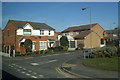
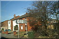


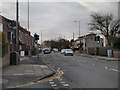

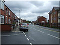

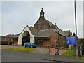
12 photos from this area
Area Information
Key information about the WA11 0AN including its size, population, and administrative classification.
- Area Type
- Postcode
- Area Size
- 1.1 hectares
- Population
- 1450
- Population Density
- 5740 people/km²
House Prices in WA11 0AN
37
Properties
£87,996
Average Sold Price
£2,000
Lowest Price
£185,000
Highest Price
Showing 37 properties
| Address | Type | Beds | Baths | Last Sale Price | Last Sale Date | |
|---|---|---|---|---|---|---|
| 292 West End Road, Haydock, St Helens, WA11 0AN | Semi-detached | 3 | 3 | £185,000 | Dec 2022 | |
| 280 West End Road, Haydock, St Helens, WA11 0AN | house | 2 | 1 | £94,000 | Mar 2022 | |
| 284 West End Road, Haydock, St Helens, WA11 0AN | Terraced | 2 | - | £70,000 | May 2021 | |
| 270 West End Road, Haydock, St Helens, WA11 0AN | Semi-detached | - | - | £22,500 | Aug 2018 | |
| 290 West End Road, Haydock, St Helens, WA11 0AN | Detached | 3 | 3 | £130,000 | Aug 2018 | |
| 212 West End Road, Haydock, St Helens, WA11 0AN | Terraced | 3 | 2 | £125,000 | Jul 2018 | |
| 286 West End Road, Haydock, St Helens, WA11 0AN | Semi-detached | 2 | 1 | £65,000 | Oct 2017 | |
| 218 West End Road, Haydock, St Helens, WA11 0AN | Terraced | - | - | £2,000 | Oct 2016 | |
| 216 West End Road, Haydock, St Helens, WA11 0AN | Terraced | - | - | £60,000 | Jun 2012 | |
| 296 West End Road, Haydock, St Helens, WA11 0AN | Detached | - | - | £146,000 | May 2005 |
Page 1 of 4
Energy Efficiency in WA11 0AN
Amenities
Schools
| Rank | School | Type | Entry gender | Ages |
|---|
Explore more schools in this area
Go to Schools tabDemographics
Household Size
One person
most common
Accommodation Type
Houses
most common
Tenure
56
majority
Ethnic Group
White
most common
Religion
N/A
most common
Household Composition
N/A
most common
Age
47
median
Adults (30-64 years)
most common
Household Deprivation
N/A
with no deprivation
NS-SEC
18
in Lower managerial occupations
Explore more demographic insights in this area
Go to Demographics tabPlanning
Planning Constraints
- Flood RiskPremium
- Ramsar Wetland SitesPremium
- Area of Outstanding Natural BeautyPremium
- Protected Nature ReservePremium
- Protected WoodlandPremium