Area Overview for SK9 4DQ
Photos of SK9 4DQ
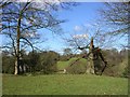
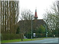
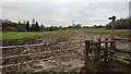
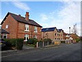
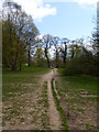
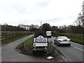
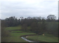
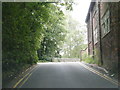
16 photos from this area
Area Information
Key information about the SK9 4DQ including its size, population, and administrative classification.
- Area Type
- Postcode
- Area Size
- 6978 m²
- Population
- 1584
- Population Density
- 4510 people/km²
House Prices in SK9 4DQ
18
Properties
£193,563
Average Sold Price
£110,000
Lowest Price
£311,000
Highest Price
Showing 18 properties
| Address | Type | Beds | Baths | Last Sale Price | Last Sale Date | |
|---|---|---|---|---|---|---|
| 32 Egerton Road, Wilmslow, SK9 4DQ | house | 2 | 1 | £311,000 | Jul 2024 | |
| 43 Egerton Road, Wilmslow, SK9 4DQ | Retail | 2 | 1 | £240,000 | Oct 2022 | |
| 34 Egerton Road, Wilmslow, SK9 4DQ | house | 2 | 1 | £297,000 | Apr 2022 | |
| 45 Egerton Road, Wilmslow, SK9 4DQ | Semi-detached | 2 | - | £160,000 | Sep 2014 | |
| 42 Egerton Road, Wilmslow, SK9 4DQ | Semi-detached | 3 | 1 | £148,000 | Aug 2011 | |
| 49 Egerton Road, Wilmslow, SK9 4DQ | house | - | - | £160,000 | Sep 2010 | |
| 55 Egerton Road, Wilmslow, SK9 4DQ | Terraced | - | - | £122,500 | Nov 2003 | |
| 30 Egerton Road, Wilmslow, SK9 4DQ | Semi-detached | - | - | £110,000 | Aug 2003 | |
| 53 Egerton Road, Wilmslow, SK9 4DQ | Semi-detached | 3 | 1 | - | - | |
| 40 Egerton Road, Wilmslow, SK9 4DQ | house | - | - | - | - |
Page 1 of 2
Energy Efficiency in SK9 4DQ
Amenities
Schools
| Rank | School | Type | Entry gender | Ages |
|---|
Explore more schools in this area
Go to Schools tabDemographics
Household Size
One person
most common
Accommodation Type
Houses
most common
Tenure
51
majority
Ethnic Group
White
most common
Religion
N/A
most common
Household Composition
N/A
most common
Age
47
median
Adults (30-64 years)
most common
Household Deprivation
N/A
with no deprivation
NS-SEC
34
in Lower managerial occupations
Explore more demographic insights in this area
Go to Demographics tabPlanning
Planning Constraints
- Flood RiskPremium
- Ramsar Wetland SitesPremium
- Area of Outstanding Natural BeautyPremium
- Protected Nature ReservePremium
- Protected WoodlandPremium