Area Overview for SK9 4AP
Photos of SK9 4AP

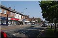
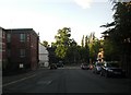
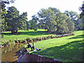
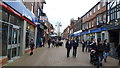
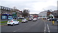
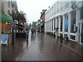
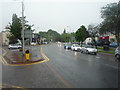
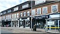
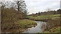
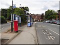
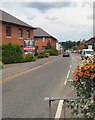
96 photos from this area
Area Information
Key information about the SK9 4AP including its size, population, and administrative classification.
- Area Type
- Postcode
- Area Size
- 9884 m²
- Population
- 1584
- Population Density
- 4510 people/km²
House Prices in SK9 4AP
29
Properties
£259,487
Average Sold Price
£67,000
Lowest Price
£645,000
Highest Price
Showing 29 properties
| Address | Type | Beds | Baths | Last Sale Price | Last Sale Date | |
|---|---|---|---|---|---|---|
| 36 Mount Pleasant, Wilmslow, SK9 4AP | Terraced | 2 | 1 | £367,500 | Oct 2025 | |
| 8 Mount Pleasant, Wilmslow, SK9 4AP | Terraced | 2 | 1 | £322,000 | May 2025 | |
| Hidden House, 3 Mount Pleasant, Wilmslow, SK9 4AP | Semi-detached | 3 | 1 | £407,250 | Sep 2024 | |
| 30 Mount Pleasant, Wilmslow, SK9 4AP | Detached | 2 | 1 | £311,000 | Jul 2024 | |
| 24 Mount Pleasant, Wilmslow, SK9 4AP | Detached | 3 | 1 | £645,000 | Nov 2023 | |
| 46 Mount Pleasant, Wilmslow, SK9 4AP | Semi-detached | 2 | 1 | £470,000 | Sep 2023 | |
| 34 Mount Pleasant, Wilmslow, SK9 4AP | Terraced | 2 | 1 | £250,000 | Jul 2023 | |
| Spring Bank, Mount Pleasant, Wilmslow, SK9 4AP | Detached | 4 | 2 | £435,000 | Nov 2021 | |
| 10 Mount Pleasant, Wilmslow, SK9 4AP | Cottage | 1 | 1 | £173,250 | Feb 2015 | |
| 24A Mount Pleasant, Wilmslow, SK9 4AP | Terraced | 4 | 1 | £410,000 | Nov 2014 |
Page 1 of 3
Energy Efficiency in SK9 4AP
Amenities
Schools
| Rank | School | Type | Entry gender | Ages |
|---|
Explore more schools in this area
Go to Schools tabDemographics
Household Size
One person
most common
Accommodation Type
Houses
most common
Tenure
51
majority
Ethnic Group
White
most common
Religion
N/A
most common
Household Composition
N/A
most common
Age
47
median
Adults (30-64 years)
most common
Household Deprivation
N/A
with no deprivation
NS-SEC
34
in Lower managerial occupations
Explore more demographic insights in this area
Go to Demographics tabPlanning
Planning Constraints
- Flood RiskPremium
- Ramsar Wetland SitesPremium
- Area of Outstanding Natural BeautyPremium
- Protected Nature ReservePremium
- Protected WoodlandPremium