Area Overview for SK15 2EN
Photos of SK15 2EN
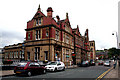
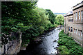
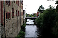
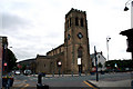
100 photos from this area
Area Information
Key information about the SK15 2EN including its size, population, and administrative classification.
- Area Type
- Postcode
- Area Size
- 1.8 hectares
- Population
- 1936
- Population Density
- 3657 people/km²
House Prices in SK15 2EN
34
Properties
£116,529
Average Sold Price
£24,500
Lowest Price
£247,500
Highest Price
Showing 34 properties
| Address | Type | Beds | Baths | Last Sale Price | Last Sale Date | |
|---|---|---|---|---|---|---|
| 78 Forester Drive, Stalybridge, SK15 2EN | Terraced | 2 | 1 | £135,000 | Feb 2025 | |
| 114 Forester Drive, Stalybridge, SK15 2EN | Terraced | 2 | 1 | £150,000 | Mar 2024 | |
| 82 Forester Drive, Stalybridge, SK15 2EN | house | - | - | £145,000 | Aug 2022 | |
| 44 Forester Drive, Stalybridge, SK15 2EN | Terraced | 2 | 1 | £180,000 | Jun 2022 | |
| 120 Forester Drive, Stalybridge, SK15 2EN | house | - | - | £190,000 | Oct 2021 | |
| 54 Forester Drive, Stalybridge, SK15 2EN | Detached | 4 | 3 | £227,500 | Aug 2021 | |
| 86 Forester Drive, Stalybridge, SK15 2EN | house | - | - | £170,000 | Jul 2021 | |
| 40-42 Forester Drive, Stalybridge, SK15 2EN | Semi-detached | 4 | 1 | £160,000 | Apr 2021 | |
| 46 Forester Drive, Stalybridge, SK15 2EN | house | 4 | 2 | £247,500 | Oct 2019 | |
| 106 Forester Drive, Stalybridge, SK15 2EN | Terraced | 2 | 1 | £155,000 | Jul 2019 |
Page 1 of 4
Energy Efficiency in SK15 2EN
Amenities
Schools
| Rank | School | Type | Entry gender | Ages |
|---|
Explore more schools in this area
Go to Schools tabDemographics
Household Size
One person
most common
Accommodation Type
Houses
most common
Tenure
44
majority
Ethnic Group
White
most common
Religion
N/A
most common
Household Composition
N/A
most common
Age
47
median
Adults (30-64 years)
most common
Household Deprivation
N/A
with no deprivation
NS-SEC
31
in Lower managerial occupations
Explore more demographic insights in this area
Go to Demographics tabPlanning
Planning Constraints
- Flood RiskPremium
- Ramsar Wetland SitesPremium
- Area of Outstanding Natural BeautyPremium
- Protected Nature ReservePremium
- Protected WoodlandPremium