Area Overview for SK15 2EQ
Photos of SK15 2EQ
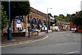
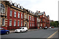
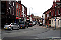

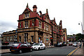
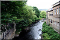
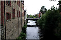

100 photos from this area
Area Information
Key information about the SK15 2EQ including its size, population, and administrative classification.
- Area Type
- Postcode
- Area Size
- 4930 m²
- Population
- 1936
- Population Density
- 3657 people/km²
House Prices in SK15 2EQ
13
Properties
£139,182
Average Sold Price
£73,000
Lowest Price
£200,000
Highest Price
Showing 13 properties
| Address | Type | Beds | Baths | Last Sale Price | Last Sale Date | |
|---|---|---|---|---|---|---|
| 85 Spring Bank, Stalybridge, SK15 2EQ | Terraced | 2 | 1 | £170,000 | Jan 2025 | |
| 83 Spring Bank, Stalybridge, SK15 2EQ | Terraced | 4 | 2 | £200,000 | Dec 2024 | |
| 77 Spring Bank, Stalybridge, SK15 2EQ | Terraced | 2 | 1 | £160,000 | Nov 2024 | |
| 87 Spring Bank, Stalybridge, SK15 2EQ | Terraced | 3 | 1 | £170,000 | Aug 2024 | |
| 91 Spring Bank, Stalybridge, SK15 2EQ | Terraced | 3 | 1 | £180,000 | Jul 2024 | |
| 81 Spring Bank, Stalybridge, SK15 2EQ | Terraced | 2 | 1 | £165,000 | Oct 2022 | |
| 71 Spring Bank, Stalybridge, SK15 2EQ | Terraced | 3 | 1 | £125,000 | Jun 2021 | |
| 75 Spring Bank, Stalybridge, SK15 2EQ | Terraced | 2 | 1 | £94,000 | Dec 2015 | |
| 73 Spring Bank, Stalybridge, SK15 2EQ | house | 2 | - | £92,000 | Nov 2010 | |
| 79 Spring Bank, Stalybridge, SK15 2EQ | Terraced | - | - | £102,000 | Aug 2008 |
Page 1 of 2
Energy Efficiency in SK15 2EQ
Amenities
Schools
| Rank | School | Type | Entry gender | Ages |
|---|
Explore more schools in this area
Go to Schools tabDemographics
Household Size
One person
most common
Accommodation Type
Houses
most common
Tenure
44
majority
Ethnic Group
White
most common
Religion
N/A
most common
Household Composition
N/A
most common
Age
47
median
Adults (30-64 years)
most common
Household Deprivation
N/A
with no deprivation
NS-SEC
31
in Lower managerial occupations
Explore more demographic insights in this area
Go to Demographics tabPlanning
Planning Constraints
- Flood RiskPremium
- Ramsar Wetland SitesPremium
- Area of Outstanding Natural BeautyPremium
- Protected Nature ReservePremium
- Protected WoodlandPremium