Area Overview for PR9 0RH
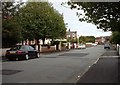
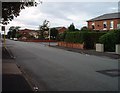
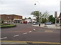
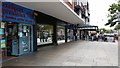
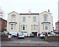
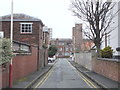
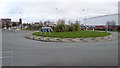
Photos of PR9 0RH


Area Information
Living in PR9 0RH means residing within a compact residential cluster spanning just 1.5 hectares. This specific postcode serves a population of 1,527 people, creating a close-knit environment where neighbours are likely to know one another. The area is densely packed, with a population density reaching 99,578 people per square kilometre. This high density indicates that the houses are situated close together, fostering a sense of community within a very defined geographic boundary. While the small size limits the scope for grand, sprawling neighbourhoods, it ensures easy walking distances between homes. Residents here experience a defined living space where the built environment dominates the landscape. There are no large open parks or extensive green belts within the immediate 1.5-hectare footprint, meaning nature access depends on facilities just beyond the postcode line. The area functions as a focused residential pocket rather than a broad suburban district. Daily life involves navigating a small cluster of dwellings where privacy and exposure are tightly balanced. The existence of such a small, defined zone suggests a mature housing stock where significant large-scale redevelopment is unlikely given the limited land available. For those seeking a home in PR9 0RH, the physical reality is a concentrated group of houses sharing local services and infrastructure efficiently.
- Area Type
- Postcode
- Area Size
- 1.5 hectares
- Population
- 1527
- Population Density
- 5499 people/km²
The property market in PR9 0RH is distinctly characterised by a high rate of home ownership at 60%. This figure indicates that the majority of the 1,527 residents in this 1.5-hectare area own their properties outright. Consequently, the market is defined by owner-occupiers rather than a high-density rental sector. The accommodation type is restricted to houses, with no flats or bungalows recorded in the specific data provided for this postcode. This means potential buyers have a uniform choice of dwelling types but may find limited variety in layout or price point compared to mixed-density neighbourhoods. The small size of the area, spanning only 1.5 hectares, further constrains the supply of available homes. There are no large housing estates or individual luxury developments likely to emerge in such a confined space. For those considering homes in PR9 0RH, the transaction process will likely involve dealing with long-term owners who view their properties as primary residences. The lack of rental stock means the area attracts buyers looking to settle down rather than short-term renters. Every property in this postcode is a house, ensuring a consistent architectural and structural identity across the small cluster. This homogeneity can appeal to buyers seeking consistency but may deter those specifically looking for different housing styles found in larger urban centres.
House Prices in PR9 0RH
Showing 55 properties
| Address | Type | Beds | Baths | Last Sale Price | Last Sale Date | |
|---|---|---|---|---|---|---|
| 82 Zetland Street, Southport, PR9 0RH | house | 4 | 1 | £165,000 | Jun 2024 | |
| 49 Zetland Street, Southport, PR9 0RH | Retail | 3 | 1 | £190,000 | Oct 2022 | |
| 39 Zetland Street, Southport, PR9 0RH | house | - | - | £210,000 | Apr 2022 | |
| 68 Zetland Street, Southport, PR9 0RH | house | - | - | £135,000 | Mar 2022 | |
| 86 Zetland Street, Southport, PR9 0RH | Semi-detached | 3 | - | £177,000 | Jun 2021 | |
| 41 Zetland Street, Southport, PR9 0RH | house | 2 | - | £120,000 | Dec 2020 | |
| 66 Zetland Street, Southport, PR9 0RH | house | - | - | £140,000 | Nov 2020 | |
| 74 Zetland Street, Southport, PR9 0RH | house | - | - | £130,000 | Apr 2020 | |
| 47 Zetland Street, Southport, PR9 0RH | house | - | - | £100,000 | Feb 2019 | |
| 42 Zetland Street, Southport, PR9 0RH | Semi-detached | 3 | - | £145,000 | Dec 2018 |
Energy Efficiency in PR9 0RH
Your daily life in PR9 0RH revolves around a short list of essential amenities within practical reach. For retail needs, there are five key shops nearby, including Spar, Asda Southport, and Farmfoods Southport. These venues provide standard grocery and household requirements. Transport connectivity is facilitated by five nearby rail stations, namely Southport Railway Station, Meols Cop Railway Station, and Birkdale Railway Station. Access to these stations allows for easy rail travel for work or leisure. There is also one airport facility nearby, identified as RAF Woodvale. While this particular airport functions primarily for military purposes, its presence indicates the strategic transport corridor serves the region. Living in PR9 0RH means being situated near major transport hubs but within a small, self-contained residential zone. The concentration of amenities five minutes away from the postcode ensures you do not need to travel far for essentials. Asda Southport is a reliable option for bulk shopping, while Spar offers quick daily necessities. The proximity of Meols Cop and Birkdale stations means you have multiple rail options for your journey to larger destinations like Liverpool or Manchester. The local lifestyle is defined by convenience and proximity to established retail and transport nodes.
Amenities
Schools
| Rank | School | Type | Entry gender | Ages |
|---|
Explore more schools in this area
Go to Schools tabDemographics
The community in PR9 0RH reflects a mature demographic profile, with a median age of 47 years. Adults between the ages of 30 and 64 years constitute the most common age range, indicating that families and working professionals make up the bulk of the population. Home ownership stands at 60%, which is a significant majority compared to national averages where rentals often play a larger role. This high ownership rate suggests that residents are likely established in the area for extended periods. The accommodation type is exclusively houses, meaning there are no flats or apartments in this specific postcode. This housing style aligns with the demographic, suggesting a family-oriented or established resident population. The predominant ethnic group is White, mirroring the wider demographic trends often found in many established UK residential areas. There is no data provided regarding specific deprivation indices or income levels, so the quality of life assessment relies on the stability implied by the high home ownership rate. The combination of houses and a median age of 47 paints a picture of a settled community. Buyers looking at homes in PR9 0RH should expect to encounter established owners rather than transient landlords. The social fabric here is anchored by long-term residents who have chosen this specific cluster for their permanent homes.
Household Size
Accommodation Type
Tenure
Ethnic Group
Religion
Household Composition
Age
Household Deprivation
NS-SEC
Explore more demographic insights in this area
Go to Demographics tabPlanning
Planning Constraints
- Flood RiskPremium
- Ramsar Wetland SitesPremium
- Area of Outstanding Natural BeautyPremium
- Protected Nature ReservePremium
- Protected WoodlandPremium