Area Overview for PR8 6DB
Photos of PR8 6DB
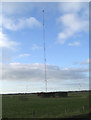
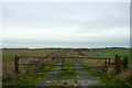
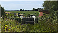

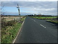
11 photos from this area
Area Information
Key information about the PR8 6DB including its size, population, and administrative classification.
- Area Type
- Postcode
- Area Size
- 7162 m²
- Population
- 2048
- Population Density
- 2365 people/km²
House Prices in PR8 6DB
26
Properties
£136,686
Average Sold Price
£55,498
Lowest Price
£217,995
Highest Price
Showing 26 properties
| Address | Type | Beds | Baths | Last Sale Price | Last Sale Date | |
|---|---|---|---|---|---|---|
| 14 Cromwell Close, Southport, PR8 6DB | house | - | - | £147,000 | Sep 2021 | |
| 33 Cromwell Close, Southport, PR8 6DB | house | - | - | £175,128 | Sep 2019 | |
| 12 Cromwell Close, Southport, PR8 6DB | house | - | - | £186,995 | Jul 2019 | |
| 27 Cromwell Close, Southport, PR8 6DB | Semi-detached | 3 | 2 | £146,246 | Jun 2019 | |
| 18 Cromwell Close, Southport, PR8 6DB | house | - | - | £55,498 | Jun 2019 | |
| 10 Cromwell Close, Southport, PR8 6DB | house | - | - | £185,000 | Jun 2019 | |
| 31 Cromwell Close, Southport, PR8 6DB | house | - | - | £179,995 | Jun 2019 | |
| 6 Cromwell Close, Southport, PR8 6DB | house | - | - | £97,497 | Jun 2019 | |
| 16 Cromwell Close, Southport, PR8 6DB | house | - | - | £55,498 | Jun 2019 | |
| 1 Cromwell Close, Southport, PR8 6DB | house | - | - | £56,698 | Jun 2019 |
Page 1 of 3
Energy Efficiency in PR8 6DB
Amenities
Schools
| Rank | School | Type | Entry gender | Ages |
|---|
Explore more schools in this area
Go to Schools tabDemographics
Household Size
Two person
most common
Accommodation Type
Houses
most common
Tenure
83
majority
Ethnic Group
White
most common
Religion
N/A
most common
Household Composition
N/A
most common
Age
47
median
Adults (30-64 years)
most common
Household Deprivation
N/A
with no deprivation
NS-SEC
39
in Lower managerial occupations
Explore more demographic insights in this area
Go to Demographics tabPlanning
Planning Constraints
- Flood RiskPremium
- Ramsar Wetland SitesPremium
- Area of Outstanding Natural BeautyPremium
- Protected Nature ReservePremium
- Protected WoodlandPremium