Area Overview for PR4 0NL
Photos of PR4 0NL


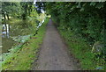


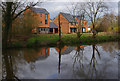
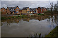


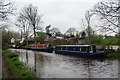
26 photos from this area
Area Information
Key information about the PR4 0NL including its size, population, and administrative classification.
- Area Type
- Postcode
- Area Size
- 2.3 hectares
- Population
- 2707
- Population Density
- 761 people/km²
House Prices in PR4 0NL
23
Properties
£264,178
Average Sold Price
£131,995
Lowest Price
£500,000
Highest Price
Showing 23 properties
| Address | Type | Beds | Baths | Last Sale Price | Last Sale Date | |
|---|---|---|---|---|---|---|
| 30 Keats Way, Preston, PR4 0NL | Detached | 4 | 2 | £405,500 | Oct 2025 | |
| 32 Keats Way, Preston, PR4 0NL | Detached | 6 | 3 | £500,000 | Nov 2024 | |
| 25 Keats Way, Preston, PR4 0NL | Detached | 4 | 3 | £478,000 | Sep 2024 | |
| 21 Keats Way, Preston, PR4 0NL | Detached | 4 | 2 | £398,000 | Aug 2024 | |
| 1 Keats Way, Preston, PR4 0NL | house | - | - | £365,000 | Nov 2020 | |
| 23 Keats Way, Preston, PR4 0NL | Detached | 4 | - | £335,000 | Aug 2014 | |
| 27 Keats Way, Preston, PR4 0NL | house | - | - | £300,000 | Jul 2010 | |
| 26 Keats Way, Preston, PR4 0NL | house | - | - | £265,000 | Jul 2009 | |
| 24 Keats Way, Preston, PR4 0NL | house | - | - | £335,000 | Apr 2009 | |
| 19 Keats Way, Preston, PR4 0NL | Detached | - | - | £320,000 | Jun 2007 |
Page 1 of 3
Energy Efficiency in PR4 0NL
Amenities
Schools
| Rank | School | Type | Entry gender | Ages |
|---|
Explore more schools in this area
Go to Schools tabDemographics
Household Size
Two person
most common
Accommodation Type
Houses
most common
Tenure
82
majority
Ethnic Group
White
most common
Religion
N/A
most common
Household Composition
N/A
most common
Age
47
median
Adults (30-64 years)
most common
Household Deprivation
N/A
with no deprivation
NS-SEC
48
in Lower managerial occupations
Explore more demographic insights in this area
Go to Demographics tabPlanning
Planning Constraints
- Flood RiskPremium
- Ramsar Wetland SitesPremium
- Area of Outstanding Natural BeautyPremium
- Protected Nature ReservePremium
- Protected WoodlandPremium