Area Overview for PR4 0HJ
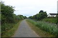
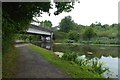
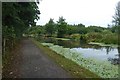
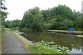
Photos of PR4 0HJ


Area Information
PR4 0HJ is a specific postcode area located in England, covering a small residential cluster of 8120 m². It shelters a population of 2707 people, creating a setting with a population density of 761 people per km². This sizeable yet compact environment supports a community where daily life revolves around local familiarity and established neighbours. You will find yourself within a postcode that functions as a distinct residential unit rather than a sprawling district. The area is characterised by its focused nature, meaning services, transport, and community gatherings are relatively close to your door. Living here offers the advantage of reduced travel times to key destinations while maintaining a sense of locality. The layout supports a lifestyle where residents can access local points of interest without needing long commutes for daily needs. Understanding the scale of this postcode helps you grasp the community dynamic. It is a place where the edge of the residential zone is clearly defined, allowing for a predictable routine for those choosing to call this spot their home.
- Area Type
- Postcode
- Area Size
- 8120 m²
- Population
- 2707
- Population Density
- 761 people/km²
The property market in PR4 0HJ is dominated by the stock of houses, which serve as the main accommodation type for the 2707 residents. With an 82% home ownership rate, this area is distinctly an owner-occupied zone rather than a rental hub. High levels of ownership imply that the local market is founded on long-term investment and stability. Buyers looking at homes in this postcode should expect a substantial supply of private households rather than new builds or seasonal rentals. The nature of the housing stock, combined with the small land area of 8120 m², means the available properties are likely to be well-established within a tight-knit cluster. This environment suits buyers seeking regularity and a neighbourhood where residents have put down roots. The high ownership percentage indicates that the local economy and social fabric are supported by a resident base that has invested in the area. When considering property in PR4 0HJ, you are entering a market where tenants are the minority and homeowners drive the local dynamics. This structure often correlates with lower tenant turnover and a steadier community atmosphere.
House Prices in PR4 0HJ
Showing 12 properties
| Address | Type | Beds | Baths | Last Sale Price | Last Sale Date | |
|---|---|---|---|---|---|---|
| 2 Wyburn Close, Cottam, Preston, PR4 0HJ | house | - | - | - | - | |
| 10 Wyburn Close, Cottam, Preston, PR4 0HJ | house | - | - | - | - | |
| 3 Wyburn Close, Cottam, Preston, PR4 0HJ | house | - | - | - | - | |
| 9 Wyburn Close, Cottam, Preston, PR4 0HJ | house | - | - | - | - | |
| 4 Wyburn Close, Cottam, Preston, PR4 0HJ | house | - | - | - | - | |
| 14 Wyburn Close, Cottam, Preston, PR4 0HJ | house | - | - | - | - | |
| 6 Wyburn Close, Cottam, Preston, PR4 0HJ | house | - | - | - | - | |
| 5 Wyburn Close, Cottam, Preston, PR4 0HJ | house | - | - | - | - | |
| 7 Wyburn Close, Cottam, Preston, PR4 0HJ | house | - | - | - | - | |
| 12 Wyburn Close, Cottam, Preston, PR4 0HJ | house | - | - | - | - |
Energy Efficiency in PR4 0HJ
Daily life in PR4 0HJ is supported by a range of amenities within practical reach of your doorstep. For shopping needs, you have five retail options nearby, including specific locations such as Co-op Cottam, Co-op Ingol, and Sainsburys Preston. These supermarkets provide you with comprehensive access to groceries and household essentials without the need to travel far. Transport links are equally convenient, with five rail stations accessible for commuters. You can reach Salwick Railway Station, Preston Railway Station, or Lostock Hall Railway Station depending on your destination. Aviation travellers also benefit from the proximity of Warton Airport, which is just one airport listed in the immediate vicinity. Having these diverse transport and shopping options integrated closely into the postcode means you can manage your daily routine efficiently. The presence of specific retailers like those in Cottam and Ingol adds to the convenience factor for local residents. When planning your daily errands, you will find that the distance to essential services is minimal, allowing for a balanced and relaxed lifestyle.
Amenities
Schools
Families living in PR4 0HJ have access to three local primary schools, all holding a 'good' Ofsted rating. These educational institutions serve as key anchors for the community and are located within practical reach of residents. The schools include Lea Neeld's Endowed Church of England Primary School, St Mary's Catholic Primary School, and Cottam Primary School. Having multiple options with positive ratings means you have several strong choices for your children's education. The mix includes both Church of England and Catholic primary schools, offering different denominational environments while maintaining high standards. All three institutions are rated 'good', providing a consistent baseline of quality for schooling near this postcode. This selection allows families to choose based on religious affiliation or specific pedagogical preferences without compromising on official ratings. When evaluating schools near PR4 0HJ, you benefit from a trio of reputable options that support the needs of local children. The presence of Cotam Primary School alongside the other two ensures a broad local network of education providers.
| Rank | School | Type | Entry gender | Ages |
|---|
Explore more schools in this area
Go to Schools tabDemographics
The community within PR4 0HJ is defined by a relatively mature demographic profile. The median age stands at 47 years, indicating that the most common age range consists of adults between 30 and 64 years. This concentration suggests the area is likely populated by established families or individuals further along in their careers. Home ownership is a clear feature of this neighbourhood, with 82% of residents owning their homes outright or via mortgage. This high figure points towards a stable community where people have settled for the long term. The predominant ethnic group is White, aligning with the broader social composition of the region. Houses form the primary type of accommodation, reinforcing the residential character of the postcode. These facts paint a picture of a settled, owner-occupied community where long-term residents form the bulk of the population. You are joining an area where the population has a strong sense of belonging and stability. The age profile and ownership levels suggest a quiet but engaged neighbourhood where family life and career stability take precedence.
Household Size
Accommodation Type
Tenure
Ethnic Group
Religion
Household Composition
Age
Household Deprivation
NS-SEC
Explore more demographic insights in this area
Go to Demographics tabPlanning
Planning Constraints
- Flood RiskPremium
- Ramsar Wetland SitesPremium
- Area of Outstanding Natural BeautyPremium
- Protected Nature ReservePremium
- Protected WoodlandPremium