Area Overview for PR4 0WH
Photos of PR4 0WH
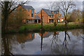
26 photos from this area
Area Information
Key information about the PR4 0WH including its size, population, and administrative classification.
- Area Type
- Postcode
- Area Size
- 1.4 hectares
- Population
- 2707
- Population Density
- 761 people/km²
House Prices in PR4 0WH
12
Properties
£261,873
Average Sold Price
£144,995
Lowest Price
£420,000
Highest Price
Showing 12 properties
| Address | Type | Beds | Baths | Last Sale Price | Last Sale Date | |
|---|---|---|---|---|---|---|
| 10 Armaside Road, Preston, PR4 0WH | Semi-detached | 4 | 3 | £310,000 | Feb 2023 | |
| 1 Armaside Road, Preston, PR4 0WH | house | 4 | - | £320,000 | Nov 2021 | |
| 7 Armaside Road, Preston, PR4 0WH | Detached | 4 | 3 | £420,000 | Aug 2019 | |
| 12 Armaside Road, Preston, PR4 0WH | Semi-detached | 4 | 2 | £237,500 | May 2018 | |
| 6 Armaside Road, Preston, PR4 0WH | Detached | 4 | 1 | £350,000 | Sep 2017 | |
| 2 Armaside Road, Preston, PR4 0WH | Detached | - | - | £215,000 | Nov 2003 | |
| 11 Armaside Road, Preston, PR4 0WH | house | - | - | £243,000 | May 2003 | |
| 8 Armaside Road, Preston, PR4 0WH | Detached | - | - | £230,000 | May 2003 | |
| 4 Armaside Road, Preston, PR4 0WH | Detached | - | - | £236,995 | Oct 2002 | |
| 3 Armaside Road, Preston, PR4 0WH | Detached | - | - | £234,995 | Apr 2002 |
Page 1 of 2
Energy Efficiency in PR4 0WH
Amenities
Schools
| Rank | School | Type | Entry gender | Ages |
|---|
Explore more schools in this area
Go to Schools tabDemographics
Household Size
Two person
most common
Accommodation Type
Houses
most common
Tenure
82
majority
Ethnic Group
White
most common
Religion
N/A
most common
Household Composition
N/A
most common
Age
47
median
Adults (30-64 years)
most common
Household Deprivation
N/A
with no deprivation
NS-SEC
48
in Lower managerial occupations
Explore more demographic insights in this area
Go to Demographics tabPlanning
Planning Constraints
- Flood RiskPremium
- Ramsar Wetland SitesPremium
- Area of Outstanding Natural BeautyPremium
- Protected Nature ReservePremium
- Protected WoodlandPremium