Area Overview for PR2 1ES
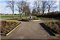
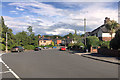
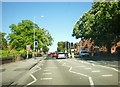
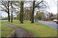
Photos of PR2 1ES


Area Information
PR2 1ES is a compact residential cluster covering just 2.2 hectares, housing a population of 1,277 people. Living in PR2 1ES means residing in a tightly knit environment where neighbours are often neighbours by necessity. The area represents a specific postcode zone rather than a sprawling town centre, offering a focused experience of suburban living close to the Ribble Valley. With a median age of 47, the community skews noticeably towards maturity, suggesting a settlement firmly established rather than rapidly developing. You will find that daily life here revolves around established routines and proximity to local hubs rather than the bustle of a major urban centre. The close proximity of homes creates a familiar atmosphere where the distinction between your immediate street and the wider neighbourhood feels seamless. Prospective buyers viewing homes in PR2 1ES should expect a community defined by its concentration and its connection to nearby towns like Ashton-on-Ribble and Tulketh. The area functions as a quiet stopover for those working in Preston or seeking a peaceful setting with reliable transport links. Its small scale ensures that you know exactly where you live, eliminating the guesswork often associated with broader postcode regions.
- Area Type
- Postcode
- Area Size
- 2.2 hectares
- Population
- 1277
- Population Density
- 2415 people/km²
The housing stock in PR2 1ES is dominated by houses, creating a landscape of detached or semi-detached properties typical of rural or semi-rural Lancashire. With an 85% home ownership rate, investors looking for buy-to-let opportunities will find limited availability in this specific postcode. The market here is primarily for owner-occupiers seeking to consolidate their families or downsize. This high ownership percentage means that when houses come onto the market in PR2 1ES, they are often motivated by life changes rather than portfolio management. The accommodation type is strictly houses, meaning you will not find apartments or flats within this small 2.2-hectare footprint. Buyers considering homes in PR2 1ES are looking for a private residence with garden space and structural independence. The lack of rental stock suggests that if you wish to live here, you need sufficient funds for a mortgage or significant savings. The environment is designed for ownership, where residents have skin in the game regarding their local infrastructure and community upkeep. Purchasing a property here secures a stake in one of the most stable micro-communities available in the region.
House Prices in PR2 1ES
Showing 18 properties
| Address | Type | Beds | Baths | Last Sale Price | Last Sale Date | |
|---|---|---|---|---|---|---|
| 213 Tulketh Road, Preston, PR2 1ES | Semi-detached | 3 | 1 | £283,000 | Oct 2023 | |
| 199 Tulketh Road, Preston, PR2 1ES | house | - | - | £335,000 | Jul 2013 | |
| 211 Tulketh Road, Preston, PR2 1ES | Terraced | 3 | - | £220,000 | May 2013 | |
| 201 Tulketh Road, Preston, PR2 1ES | house | - | - | £290,000 | Jun 2006 | |
| 207 Tulketh Road, Preston, PR2 1ES | Semi-detached | - | - | £192,000 | Aug 2005 | |
| 205 Tulketh Road, Preston, PR2 1ES | Semi-detached | - | - | £73,000 | May 1999 | |
| 203 Tulketh Road, Preston, PR2 1ES | Detached | - | - | £139,950 | Mar 1997 | |
| 207A Tulketh Road, Preston, PR2 1ES | Detached | 3 | 2 | - | - | |
| Trivelles Park Hotel, Managers Accommodation, 209 Tulketh Road, Preston, PR2 1ES | Flat | 1 | 1 | - | - | |
| 215A Tulketh Road, Preston, PR2 1ES | Flat | 18 | - | - | - |
Energy Efficiency in PR2 1ES
Residents of PR2 1ES enjoy practical access to essential services within a reasonable travelling distance. For retail needs, five local options exist, including Morrisons Ashton-on, Tesco Tulketh, and Spar. These venues provide everything from fresh groceries to household essentials, keeping daily errands efficient. You can stock your kitchen at Tesco Tulketh or pick up specific items at the nearby Morrisons Ashton-on branch. For those who rely on rail transport, five stations are within practical reach, including Preston Railway Station, Salwick Railway Station, and Lostock Hall Railway Station. Preston Railway Station offers journeys to major cities, while the smaller local stations handle regional travel. This mix ensures you can commute to work or take leisure trips without being isolated. Living in PR2 1ES balances the peace of a quiet cluster with the convenience of established retail chains and reliable rail links. The proximity of these amenities means you do not need to travel far for basic needs, preserving time for other aspects of life. The character of the area is shaped by this accessibility to the wider network while maintaining a residential focus.
Amenities
Schools
Prospective families considering schools near PR2 1ES have one primary local option clearly identified for the immediate proximity. Ashton-on-Ribble St Andrew's Church of England Primary School serves the educational needs of young children in the vicinity. This institution holds a 'good' Ofsted rating, providing confidence for parents regarding the quality of education and care offered. As a primary school, it caters to the early stages of a child's academic journey, which aligns with the demographic profile of residents aged 30-64 years who may have school-age children. The area does not list secondary schools in its immediate data set, suggesting that older students likely travel to Preston or other larger towns in Lambley. Choosing to live in PR2 1ES places you within easy reach of a single, well-regarded primary institution. You can assess the school directly rather than relying on distant catchment areas. This clarity allows parents to make informed decisions about their child's schooling based on tangible performance metrics rather than speculation about facilities they have never visited.
| Rank | School | Type | Entry gender | Ages |
|---|
Explore more schools in this area
Go to Schools tabDemographics
The community within PR2 1ES is defined by stability and a mature age profile. Eighty-five per cent of households in this postcode own their homes, indicating a high level of long-term settlement. This strong ownership rate contrasts with areas where rentals dominate, reflecting a population that views this location as a permanent home. The majority of residents fall into the 30-64 years age range, with a median age of 47 years old. This demographic concentration suggests the area attracts families with children who have grown up, or professionals past their early career years. The accommodation type is exclusively houses, providing a homogeneous environment where your experience of the neighbourhood is consistent regardless of the street you choose. The predominant ethnic group is White, aligning with the traditional character of many communities in this part of Lancashire. Living in PR2 1ES offers a slice of life where established roots are more common than transient populations. You are moving into a community where people are likely to be settled and focused on maintaining their residences and local connections rather than temporary stays.
Household Size
Accommodation Type
Tenure
Ethnic Group
Religion
Household Composition
Age
Household Deprivation
NS-SEC
Explore more demographic insights in this area
Go to Demographics tabPlanning
Planning Constraints
- Flood RiskPremium
- Ramsar Wetland SitesPremium
- Area of Outstanding Natural BeautyPremium
- Protected Nature ReservePremium
- Protected WoodlandPremium