Area Overview for PR2 1ET
Photos of PR2 1ET
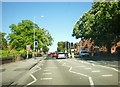
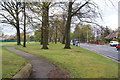
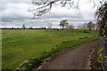
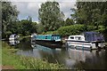
33 photos from this area
Area Information
Key information about the PR2 1ET including its size, population, and administrative classification.
- Area Type
- Postcode
- Area Size
- 1.0 hectares
- Population
- 1399
- Population Density
- 3286 people/km²
House Prices in PR2 1ET
23
Properties
£164,188
Average Sold Price
£50,000
Lowest Price
£355,000
Highest Price
Showing 23 properties
| Address | Type | Beds | Baths | Last Sale Price | Last Sale Date | |
|---|---|---|---|---|---|---|
| 10 Winmarleigh Road, Preston, PR2 1ET | Detached | 3 | 1 | £265,000 | Nov 2025 | |
| 8 Winmarleigh Road, Preston, PR2 1ET | house | - | - | £130,000 | Aug 2024 | |
| 6 Winmarleigh Road, Preston, PR2 1ET | house | - | - | £175,000 | Dec 2020 | |
| Lane End, 30 Winmarleigh Road, Preston, PR2 1ET | Detached | 4 | 3 | £355,000 | Nov 2020 | |
| 4 Winmarleigh Road, Preston, PR2 1ET | house | - | - | £257,000 | Jul 2020 | |
| 19 Winmarleigh Road, Preston, PR2 1ET | Semi-detached | 3 | 1 | £165,000 | Jul 2020 | |
| 22 Winmarleigh Road, Preston, PR2 1ET | Semi-detached | 3 | 1 | £190,000 | Sep 2018 | |
| 14 Winmarleigh Road, Preston, PR2 1ET | house | 3 | 1 | £155,000 | Jan 2018 | |
| 7 Winmarleigh Road, Preston, PR2 1ET | Semi-detached | 3 | 1 | £218,000 | Jul 2017 | |
| 15 Winmarleigh Road, Preston, PR2 1ET | Semi-detached | 3 | 2 | £147,000 | Oct 2011 |
Page 1 of 3
Energy Efficiency in PR2 1ET
Amenities
Schools
| Rank | School | Type | Entry gender | Ages |
|---|
Explore more schools in this area
Go to Schools tabDemographics
Household Size
Two person
most common
Accommodation Type
Houses
most common
Tenure
81
majority
Ethnic Group
White
most common
Religion
N/A
most common
Household Composition
N/A
most common
Age
47
median
Adults (30-64 years)
most common
Household Deprivation
N/A
with no deprivation
NS-SEC
42
in Lower managerial occupations
Explore more demographic insights in this area
Go to Demographics tabPlanning
Planning Constraints
- Flood RiskPremium
- Ramsar Wetland SitesPremium
- Area of Outstanding Natural BeautyPremium
- Protected Nature ReservePremium
- Protected WoodlandPremium