Area Overview for PR2 1EQ
Photos of PR2 1EQ
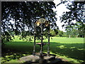
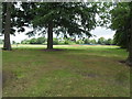
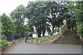
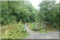
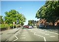
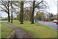
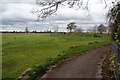
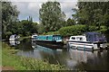
33 photos from this area
Area Information
Key information about the PR2 1EQ including its size, population, and administrative classification.
- Area Type
- Postcode
- Area Size
- 1.5 hectares
- Population
- 1277
- Population Density
- 2415 people/km²
House Prices in PR2 1EQ
17
Properties
£147,295
Average Sold Price
£50,000
Lowest Price
£325,000
Highest Price
Showing 17 properties
| Address | Type | Beds | Baths | Last Sale Price | Last Sale Date | |
|---|---|---|---|---|---|---|
| 513 Blackpool Road, Preston, PR2 1EQ | Detached | 4 | 1 | £210,000 | Dec 2021 | |
| 507 Blackpool Road, Preston, PR2 1EQ | Detached | 9 | 3 | £325,000 | Jul 2019 | |
| 525 Blackpool Road, Preston, PR2 1EQ | Detached | 3 | 2 | £195,000 | Nov 2011 | |
| 527 Blackpool Road, Preston, PR2 1EQ | house | 3 | - | £195,000 | Jul 2010 | |
| 503 Blackpool Road, Preston, PR2 1EQ | house | 1 | 2 | £113,000 | May 2007 | |
| 523 Blackpool Road, Preston, PR2 1EQ | house | - | - | £180,000 | Nov 2001 | |
| 533 Blackpool Road, Preston, PR2 1EQ | Terraced | - | - | £50,000 | Nov 2000 | |
| 505 Blackpool Road, Preston, PR2 1EQ | Bungalow | 2 | - | £88,950 | Nov 1999 | |
| 529 Blackpool Road, Preston, PR2 1EQ | Terraced | - | - | £62,000 | Oct 1998 | |
| 511 Blackpool Road, Preston, PR2 1EQ | Terraced | - | - | £54,000 | Mar 1995 |
Page 1 of 2
Energy Efficiency in PR2 1EQ
Amenities
Schools
| Rank | School | Type | Entry gender | Ages |
|---|
Explore more schools in this area
Go to Schools tabDemographics
Household Size
Family (3-5 people)
most common
Accommodation Type
Houses
most common
Tenure
85
majority
Ethnic Group
White
most common
Religion
N/A
most common
Household Composition
N/A
most common
Age
47
median
Adults (30-64 years)
most common
Household Deprivation
N/A
with no deprivation
NS-SEC
42
in Lower managerial occupations
Explore more demographic insights in this area
Go to Demographics tabPlanning
Planning Constraints
- Flood RiskPremium
- Ramsar Wetland SitesPremium
- Area of Outstanding Natural BeautyPremium
- Protected Nature ReservePremium
- Protected WoodlandPremium