Area Overview for PR1 7XT
Photos of PR1 7XT
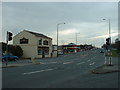
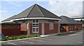
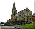
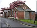
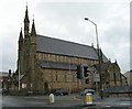
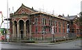
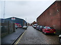
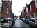
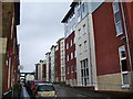
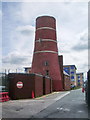
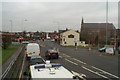
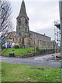
71 photos from this area
Area Information
Key information about the PR1 7XT including its size, population, and administrative classification.
- Area Type
- Postcode
- Area Size
- 1902 m²
- Population
- 1935
- Population Density
- 13914 people/km²
House Prices in PR1 7XT
18
Properties
£79,167
Average Sold Price
£30,000
Lowest Price
£127,000
Highest Price
Showing 18 properties
| Address | Type | Beds | Baths | Last Sale Price | Last Sale Date | |
|---|---|---|---|---|---|---|
| 59 Lowndes Street, Preston, PR1 7XT | Terraced | 4 | 1 | £127,000 | Nov 2024 | |
| 71 Lowndes Street, Preston, PR1 7XT | Terraced | 3 | 1 | £97,500 | May 2023 | |
| 61 Lowndes Street, Preston, PR1 7XT | Terraced | 2 | 1 | £85,000 | Feb 2021 | |
| 75 Lowndes Street, Preston, PR1 7XT | Terraced | 2 | 1 | £78,500 | Jun 2017 | |
| 85 Lowndes Street, Preston, PR1 7XT | Terraced | 2 | - | £66,000 | Jun 2017 | |
| 63 Lowndes Street, Preston, PR1 7XT | house | - | - | £68,500 | Jun 2016 | |
| 55 Lowndes Street, Preston, PR1 7XT | Terraced | 2 | 1 | £62,000 | May 2013 | |
| 81 Lowndes Street, Preston, PR1 7XT | house | - | - | £118,500 | Jul 2007 | |
| 65 Lowndes Street, Preston, PR1 7XT | house | - | - | £86,500 | Sep 2006 | |
| 79 Lowndes Street, Preston, PR1 7XT | house | - | - | £91,500 | Apr 2006 |
Page 1 of 2
Energy Efficiency in PR1 7XT
Amenities
Schools
| Rank | School | Type | Entry gender | Ages |
|---|
Explore more schools in this area
Go to Schools tabDemographics
Household Size
One person
most common
Accommodation Type
Houses
most common
Tenure
28
majority
Ethnic Group
White
most common
Religion
N/A
most common
Household Composition
N/A
most common
Age
22
median
Adults (30-64 years)
most common
Household Deprivation
N/A
with no deprivation
NS-SEC
15
in Lower managerial occupations
Explore more demographic insights in this area
Go to Demographics tabPlanning
Planning Constraints
- Flood RiskPremium
- Ramsar Wetland SitesPremium
- Area of Outstanding Natural BeautyPremium
- Protected Nature ReservePremium
- Protected WoodlandPremium