Area Overview for PR1 7UD
Photos of PR1 7UD
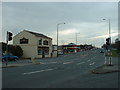
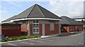
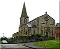
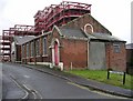
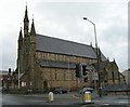
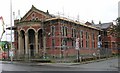
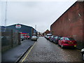
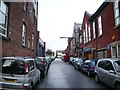
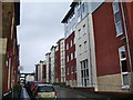
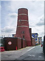
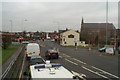
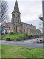
71 photos from this area
Area Information
Key information about the PR1 7UD including its size, population, and administrative classification.
- Area Type
- Postcode
- Area Size
- 4878 m²
- Population
- 1693
- Population Density
- 10286 people/km²
House Prices in PR1 7UD
42
Properties
£69,583
Average Sold Price
£19,250
Lowest Price
£116,000
Highest Price
Showing 42 properties
| Address | Type | Beds | Baths | Last Sale Price | Last Sale Date | |
|---|---|---|---|---|---|---|
| 154 Plungington Road, Preston, PR1 7UD | Terraced | 2 | 1 | £105,000 | Nov 2025 | |
| 148 Plungington Road, Preston, PR1 7UD | Terraced | 3 | 1 | £116,000 | Oct 2025 | |
| 141 Plungington Road, Preston, PR1 7UD | Terraced | 2 | - | £93,000 | Apr 2025 | |
| 180A Plungington Road, Preston, PR1 7UD | Flat | - | - | £55,000 | Mar 2025 | |
| 155 Plungington Road, Preston, PR1 7UD | house | - | - | £80,000 | Jan 2024 | |
| 168 Plungington Road, Preston, PR1 7UD | house | - | - | £88,000 | Sep 2022 | |
| 161 Plungington Road, Preston, PR1 7UD | Retail | 3 | - | £81,000 | Jun 2022 | |
| 166 Plungington Road, Preston, PR1 7UD | house | - | - | £60,000 | Jan 2022 | |
| 162 Plungington Road, Preston, PR1 7UD | Terraced | 2 | 1 | £75,000 | Mar 2021 | |
| 146 Plungington Road, Preston, PR1 7UD | house | - | - | £50,000 | Oct 2018 |
Page 1 of 5
Energy Efficiency in PR1 7UD
Amenities
Schools
| Rank | School | Type | Entry gender | Ages |
|---|
Explore more schools in this area
Go to Schools tabDemographics
Household Size
Family (3-5 people)
most common
Accommodation Type
Houses
most common
Tenure
44
majority
Ethnic Group
White
most common
Religion
N/A
most common
Household Composition
N/A
most common
Age
47
median
Adults (30-64 years)
most common
Household Deprivation
N/A
with no deprivation
NS-SEC
25
in Lower managerial occupations
Explore more demographic insights in this area
Go to Demographics tabPlanning
Planning Constraints
- Flood RiskPremium
- Ramsar Wetland SitesPremium
- Area of Outstanding Natural BeautyPremium
- Protected Nature ReservePremium
- Protected WoodlandPremium