Area Overview for M5 5GA
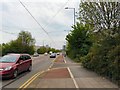
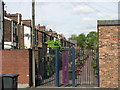
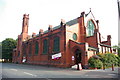
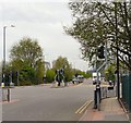
Photos of M5 5GA


Area Information
Living in M5 5GA means being part of a densely populated, small-scale residential cluster in England. The area covers 8,014 square metres and is home to 1,661 residents, making it one of the most densely populated postcode areas in the country, with 207,267 people per square kilometre. This compactness shapes daily life, with a strong focus on proximity to local services and transport links. The community is predominantly composed of adults aged 30–64, reflecting a mature demographic. While the area lacks large-scale amenities, its strategic location near key infrastructure—such as rail stations and retail hubs—offers convenience for commuters and shoppers. M5 5GA is not a place for those seeking sprawling landscapes; instead, it caters to those prioritising accessibility over space. Its small size means residents are likely to know their neighbours, though the high population density may impact privacy. The area’s character is defined by its practicality, with a mix of houses and a low home ownership rate suggesting a rental-driven market. For those considering M5 5GA, the challenge lies in balancing its compact, connected nature with the potential limitations of its size.
- Area Type
- Postcode
- Area Size
- 8014 m²
- Population
- 1661
- Population Density
- 2590 people/km²
The property market in M5 5GA is characterised by a low home ownership rate of 31%, suggesting that the area is more rental-oriented than owner-occupied. Despite this, the predominant accommodation type is houses, which is atypical for a densely populated postcode. This mix may indicate a legacy of older, larger properties that have been subdivided or adapted for rental purposes. The small area size and high population density mean housing stock is limited, which could make the market competitive for buyers. For those seeking owner-occupied homes, the low ownership rate may reflect challenges in affordability or a preference for renting in a compact, service-rich environment. The focus on houses rather than flats or apartments may appeal to those prioritising space, though the area’s size constrains options. Buyers should consider the implications of a rental-driven market, including potential pressure on property prices and the need for flexibility in housing choices.
House Prices in M5 5GA
Showing 25 properties
| Address | Type | Beds | Baths | Last Sale Price | Last Sale Date | |
|---|---|---|---|---|---|---|
| 24 My Street, Salford, M5 5GA | Terraced | 2 | 1 | £220,000 | Mar 2025 | |
| 3 My Street, Salford, M5 5GA | Bungalow | 3 | 1 | £203,500 | Nov 2021 | |
| 26 My Street, Salford, M5 5GA | Terraced | 3 | 1 | £124,999 | Sep 2008 | |
| 4 My Street, Salford, M5 5GA | Flat | 3 | 1 | - | - | |
| 7 My Street, Salford, M5 5GA | house | - | - | - | - | |
| 15 My Street, Salford, M5 5GA | house | - | - | - | - | |
| 8 My Street, Salford, M5 5GA | Flat | - | - | - | - | |
| 14 My Street, Salford, M5 5GA | Flat | - | - | - | - | |
| 28 My Street, Salford, M5 5GA | house | - | - | - | - | |
| 32 My Street, Salford, M5 5GA | house | - | - | - | - |
Energy Efficiency in M5 5GA
Residents of M5 5GA benefit from a range of nearby amenities that cater to daily needs and leisure. The area is within practical reach of five metro stations, including Langworthy, Broadway, and Harbour City, offering convenient access to public transport. Retail options are plentiful, with Lidl Pendleton, Sainsburys Salford, and Aldi Pendleton providing essential shopping. Rail services at Salford Crescent, Manchester United FC, and Eccles stations connect residents to broader networks, while the Chorlton Street Coach Station offers additional transport flexibility. For air travel, City Airport Manchester is a short journey away. The area’s proximity to these amenities fosters a practical, connected lifestyle, though the single bus stop and limited leisure venues suggest a focus on functional rather than recreational spaces. The compact nature of M5 5GA means residents can access services without long commutes, though the lack of expansive parks or cultural hubs may require venturing further for more varied leisure options.
Amenities
Schools
Residents of M5 5GA have access to two schools within practical reach. King of Kings is an independent school with an Ofsted rating of satisfactory, offering a private education option. All Souls RC Primary School is a state-funded primary institution, providing a Catholic education for younger children. The presence of both independent and state schools gives families choice, though the Ofsted rating for the independent school suggests room for improvement in standards. For parents prioritising state education, All Souls RC Primary offers a faith-based alternative, while King of Kings caters to those seeking private schooling. The proximity of these schools to the area is a key consideration for families, though the limited number of options may necessitate commuting for secondary education. The mix of school types reflects a balance between public and private education, but the lack of additional schools means the area’s educational offerings are constrained.
| Rank | School | Type | Entry gender | Ages |
|---|
Explore more schools in this area
Go to Schools tabDemographics
The community in M5 5GA is predominantly composed of adults aged 30–64, with a median age of 47. This suggests a stable, established population rather than a transient one. Home ownership is relatively low at 31%, indicating that a majority of residents rent their homes. The accommodation type is primarily houses, which is unusual for a densely populated area, suggesting a mix of older, larger properties. The predominant ethnic group is White, with no data provided on other groups. The population density of 207,267 people per square kilometre is exceptionally high, comparable to urban centres, which may influence social dynamics and the availability of private space. This density, combined with the age profile, implies a community focused on stability and long-term residence. However, the lack of diversity data means the full picture of the area’s social composition remains incomplete. For residents, the high density may mean shared resources and services, but it also raises questions about the sustainability of infrastructure in such a confined space.
Household Size
Accommodation Type
Tenure
Ethnic Group
Religion
Household Composition
Age
Household Deprivation
NS-SEC
Explore more demographic insights in this area
Go to Demographics tabPlanning
Planning Constraints
- Flood RiskPremium
- Ramsar Wetland SitesPremium
- Area of Outstanding Natural BeautyPremium
- Protected Nature ReservePremium
- Protected WoodlandPremium