Area Overview for M5 4FD
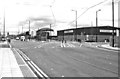
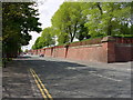
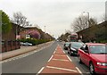
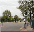
Photos of M5 4FD


Area Information
Living in M5 4FD means inhabiting a compact residential cluster in England, where 2,442 people reside across just 2.3 hectares. This makes it one of the most densely populated areas in the country, with 107,636 people per square kilometre. The area’s small size and high density create a tightly knit community, though its limited space means every square metre is accounted for. The demographic profile reflects a mature population, with a median age of 47 and the majority of residents falling between 30 and 64 years old. This suggests a community of working-age adults, many of whom may be commuting to nearby urban hubs. Daily life here is shaped by proximity to transport links, retail, and cultural amenities, though the area’s compact nature means residents must balance convenience with the constraints of a small footprint. The presence of multiple schools, rail stations, and retail outlets within walking distance highlights its practicality, while the high population density underscores the need for efficient planning and shared spaces.
- Area Type
- Postcode
- Area Size
- 2.3 hectares
- Population
- 2442
- Population Density
- 4666 people/km²
The property market in M5 4FD is characterised by a low home ownership rate of 19%, which indicates that the majority of residents are renting rather than owning their homes. This suggests a rental market that may be more competitive, with limited availability of owner-occupied properties. The accommodation type is predominantly houses, which is notable in such a densely populated area. This mix may imply a blend of traditional housing stock and newer developments, though the small area size means the housing stock is likely constrained. For buyers, this presents challenges: the limited number of owner-occupied homes may make finding a property for purchase difficult, and the area’s compact nature means any property available is likely to be in high demand. Prospective buyers should consider the rental market dynamics and whether the area’s proximity to amenities offsets the potential limitations of property availability.
House Prices in M5 4FD
Showing 27 properties
| Address | Type | Beds | Baths | Last Sale Price | Last Sale Date | |
|---|---|---|---|---|---|---|
| 2 Buckingham Street, Salford, M5 4FD | Terraced | 3 | 1 | £165,000 | Mar 2024 | |
| 1 Buckingham Street, Salford, M5 4FD | house | - | - | - | - | |
| 27 Buckingham Street, Salford, M5 4FD | house | - | - | - | - | |
| 15 Buckingham Street, Salford, M5 4FD | house | - | - | - | - | |
| 19 Buckingham Street, Salford, M5 4FD | house | - | - | - | - | |
| 33 Buckingham Street, Salford, M5 4FD | house | - | - | - | - | |
| 7 Buckingham Street, Salford, M5 4FD | house | - | - | - | - | |
| 17 Buckingham Street, Salford, M5 4FD | house | - | - | - | - | |
| 21 Buckingham Street, Salford, M5 4FD | house | - | - | - | - | |
| 3 Buckingham Street, Salford, M5 4FD | house | - | - | - | - |
Energy Efficiency in M5 4FD
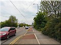
Residents of M5 4FD enjoy a lifestyle shaped by proximity to a range of amenities. The area’s retail options include Lidl Pendleton, Aldi Pendleton, and Co-op Salford, providing access to groceries and everyday essentials. Metro stations like Langworthy, Broadway, and Harbour City offer easy access to urban hubs, while rail stations such as Salford Crescent and Salford Central facilitate commuting. The presence of City Airport Manchester adds to the area’s connectivity. Though the data does not explicitly mention parks or leisure facilities, the compact layout suggests that residents may rely on nearby public spaces or community hubs. The mix of retail, transport, and cultural amenities within walking distance creates a convenient, though potentially compact, lifestyle. This makes M5 4FD ideal for those prioritising accessibility over expansive living spaces.
Amenities
Schools
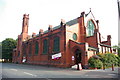
Residents of M5 4FD have access to two primary schools: West Liverpool Street Community Primary School and Lark Hill Community Primary School. The latter holds a ‘good’ Ofsted rating, which is a positive indicator for parents seeking quality education for their children. The presence of two primary schools provides families with options, though the absence of secondary schools in the immediate area may require commuting to nearby districts. The mix of schools suggests a focus on early education, which is typical for smaller residential clusters. For families, this means the area is well-suited for young children but may require planning for secondary education. The ‘good’ rating at Lark Hill adds a layer of reassurance, though the lack of detailed performance data means further research into specific curricula or facilities would be necessary.
| Rank | School | Type | Entry gender | Ages |
|---|
Explore more schools in this area
Go to Schools tabDemographics
The community in M5 4FD is predominantly composed of adults aged 30–64, with a median age of 47. This suggests a population skewed towards middle-aged individuals, likely many of whom are employed in nearby cities or industries. Only 19% of residents own their homes, indicating a rental market that may reflect a transient or younger demographic. The accommodation type is primarily houses, which is unusual for an area with such high density, hinting at a mix of single-family homes and possibly shared housing. The predominant ethnic group is White, though the data does not provide further details on diversity or deprivation levels. The low home ownership rate may influence the area’s social dynamics, with a higher proportion of tenants potentially affecting community stability. For quality of life, the absence of specific deprivation data means it is unclear whether affordability or access to services is a concern, though the presence of multiple schools and transport links suggests basic needs are met.
Household Size
Accommodation Type
Tenure
Ethnic Group
Religion
Household Composition
Age
Household Deprivation
NS-SEC
Explore more demographic insights in this area
Go to Demographics tabPlanning
Planning Constraints
- Flood RiskPremium
- Ramsar Wetland SitesPremium
- Area of Outstanding Natural BeautyPremium
- Protected Nature ReservePremium
- Protected WoodlandPremium