Area Overview for M5 5GH
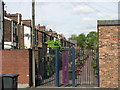
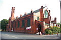
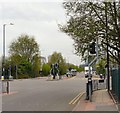
Photos of M5 5GH


Area Information
Living in M5 5GH means inhabiting a compact residential cluster in England, where 1,661 people reside across 1,485 square metres. This results in a population density of over 1.1 million per square kilometre, reflecting a densely populated, tightly knit community. The area is characterised by its small scale, with homes predominantly in private ownership, though only 31% of residents own their properties. The median age of 47 suggests a mature population, with the majority aged between 30 and 64. Daily life here is shaped by proximity to key infrastructure, including multiple rail and metro stations, retail outlets, and transport links. While the area lacks natural landscapes or protected sites, its strategic location near Salford and Manchester offers access to urban amenities. Residents benefit from nearby schools, supermarkets, and public transport, though the high population density may influence the pace of life. M5 5GH is a pragmatic choice for those prioritising connectivity over spacious surroundings.
- Area Type
- Postcode
- Area Size
- 1485 m²
- Population
- 1661
- Population Density
- 2590 people/km²
The property market in M5 5GH is defined by its small scale and limited housing stock. With 31% of residents owning their homes, the area leans more towards a rental market than owner-occupation. The predominant accommodation type is houses, which may appeal to families or individuals seeking more space than flats. However, the small area size means housing options are constrained, and buyers should consider the limited scope for expansion or development. The high population density suggests that properties here are likely to be in high demand, particularly for those prioritising proximity to transport and amenities. For buyers, the challenge lies in navigating a tight market with fewer properties available. The focus on houses may also mean higher prices relative to smaller units, though the exact cost of homes is not detailed in the data.
House Prices in M5 5GH
Showing 8 properties
| Address | Type | Beds | Baths | Last Sale Price | Last Sale Date | |
|---|---|---|---|---|---|---|
| Flat 2, Stowell House, My Street, Salford, M5 5GH | Maisonette | 3 | 1 | - | - | |
| Flat 1, Stowell House, My Street, Salford, M5 5GH | Maisonette | 3 | 1 | - | - | |
| Flat 4, Stowell House, My Street, Salford, M5 5GH | Maisonette | - | - | - | - | |
| Flat 8, Stowell House, My Street, Salford, M5 5GH | Flat | 3 | 1 | - | - | |
| Flat 7, Stowell House, My Street, Salford, M5 5GH | Maisonette | 3 | 1 | - | - | |
| Flat 5, Stowell House, My Street, Salford, M5 5GH | Maisonette | 3 | 1 | - | - | |
| Flat 6, Stowell House, My Street, Salford, M5 5GH | Maisonette | 3 | - | - | - | |
| Flat 3, Stowell House, My Street, Salford, M5 5GH | Maisonette | 3 | 1 | - | - |
Energy Efficiency in M5 5GH
The lifestyle in M5 5GH is shaped by its proximity to a variety of amenities. Residents have access to five metro stations, including Langworthy and Weaste, offering frequent transport options. Retail choices include Lidl Pendleton, Sainsburys Salford, and Co-op Salford, ensuring daily shopping needs are met. Rail services at Salford Crescent and Eccles stations provide links to Manchester and beyond, while the Chorlton Street Coach Station adds flexibility for local travel. The nearby City Airport Manchester enhances connectivity for air travel. The area’s compact nature means amenities are within practical reach, though the lack of natural spaces or leisure facilities suggests a focus on urban convenience. The mix of retail, transport, and proximity to major hubs makes daily life efficient, though it may lack the green spaces preferred by some.
Amenities
Schools
Residents of M5 5GH have access to two notable schools. King of Kings is an independent school with an Ofsted rating of satisfactory, offering an alternative to state education. All Souls RC Primary School is a state-funded primary institution, providing a religiously affiliated option for younger children. The presence of both independent and state schools creates a range of educational choices, though the data does not specify the quality or performance of these institutions beyond Ofsted’s rating. Families seeking independent education may find King of Kings suitable, while those preferring state schooling can rely on All Souls. The proximity of these schools to the area suggests they are well-integrated into the local community, supporting the needs of residents with children.
| Rank | School | Type | Entry gender | Ages |
|---|
Explore more schools in this area
Go to Schools tabDemographics
The community in M5 5GH is predominantly composed of adults aged 30 to 64, with a median age of 47. This suggests a mature population, likely with established careers and families. Home ownership is relatively low at 31%, indicating a significant proportion of residents are renters. The area is dominated by houses rather than flats or apartments, aligning with the demographic profile of older, settled individuals. The predominant ethnic group is White, though no specific data on diversity or deprivation is provided. The high population density of 1.1 million per square kilometre implies a compact, possibly urbanised environment. This density may contribute to a sense of community but could also mean limited space for expansion. The age profile suggests a stable population with potential demand for local services, including healthcare and education, which are likely to be well-served given the area’s connectivity.
Household Size
Accommodation Type
Tenure
Ethnic Group
Religion
Household Composition
Age
Household Deprivation
NS-SEC
Explore more demographic insights in this area
Go to Demographics tabPlanning
Planning Constraints
- Flood RiskPremium
- Ramsar Wetland SitesPremium
- Area of Outstanding Natural BeautyPremium
- Protected Nature ReservePremium
- Protected WoodlandPremium