Area Overview for M5 3NH
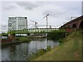
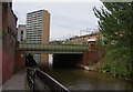
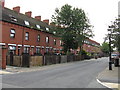
Photos of M5 3NH


Area Information
Living in M5 3NH means being part of a densely populated residential cluster in England’s north-west, where 2,138 people inhabit just 6,569 square metres. This small area is characterised by its compact footprint and proximity to major urban hubs. The population density of 325,454 people per square kilometre reflects a tightly knit community, though the area’s size limits its physical expansion. Daily life here is shaped by its location near transport networks and retail nodes, with residents benefiting from swift access to metro, rail, and bus services. The area’s compact nature means amenities are closely grouped, making it convenient for those prioritising accessibility over sprawling open spaces. While it lacks the sprawling greenery of larger towns, M5 3NH’s proximity to Manchester’s economic and cultural centres offers opportunities for work and leisure. Its demographics suggest a young, dynamic population, with 16% of homes owned outright and the rest likely rented, indicating a mix of transient and long-term residents.
- Area Type
- Postcode
- Area Size
- 6569 m²
- Population
- 2138
- Population Density
- 8329 people/km²
The property market in M5 3NH is dominated by rental rather than owner-occupied homes, with just 16% of properties owned outright. This suggests a market skewed towards tenants, possibly due to the area’s compact size and its role as a stopgap for commuters or students. The accommodation type is primarily houses, which is notable for a small postcode area but may reflect a mix of older family homes and newer builds. Buyers should consider that the limited area size means housing stock is finite, and the proximity to transport links may make this a strategic location for investors. However, the low home ownership rate indicates limited demand for long-term residential purchases, which could affect property value growth. For those seeking a home, the availability of houses may appeal to families, though the area’s density and lack of larger developments may restrict options.
House Prices in M5 3NH
Showing 22 properties
| Address | Type | Beds | Baths | Last Sale Price | Last Sale Date | |
|---|---|---|---|---|---|---|
| 14 Wyatt Avenue, Salford, M5 3NH | Terraced | 3 | 1 | £265,000 | Nov 2024 | |
| 1 Wyatt Avenue, Salford, M5 3NH | Terraced | 3 | 1 | £136,000 | Feb 2017 | |
| 9 Wyatt Avenue, Salford, M5 3NH | Terraced | 3 | - | £102,000 | Apr 2015 | |
| 5 Wyatt Avenue, Salford, M5 3NH | Terraced | 3 | 1 | - | - | |
| 28, Thorpe View, Ordsall Drive, Salford, M5 3NH | Flat | - | - | - | - | |
| 18, Thorpe View, Ordsall Drive, Salford, M5 3NH | Flat | - | - | - | - | |
| 8, Thorpe View, Ordsall Drive, Salford, M5 3NH | Flat | - | - | - | - | |
| 24 Wyatt Avenue, Salford, M5 3NH | Semi-detached | - | - | - | - | |
| 26 Wyatt Avenue, Salford, M5 3NH | Semi-detached | - | - | - | - | |
| 11 Wyatt Avenue, Salford, M5 3NH | house | - | - | - | - |
Energy Efficiency in M5 3NH
Residents of M5 3NH enjoy a range of amenities within easy reach, including retail outlets like Co-op Salford and Morrisons Daily, which cater to everyday shopping needs. The area’s transport links to metro, rail, and bus services ensure swift access to Manchester’s wider urban landscape, including leisure and cultural hubs. Nearby venues such as Salford Quays and Exchange Quay offer dining, entertainment, and public spaces, while the proximity to Manchester City Airport adds to the area’s convenience. The compact nature of M5 3NH means amenities are clustered, reducing travel time for essentials. However, the lack of green spaces or parks within the immediate area may require residents to venture further for outdoor activities. The mix of retail, transport, and leisure options supports a lifestyle focused on accessibility and urban connectivity.
Amenities
Schools
Residents of M5 3NH have access to two primary educational institutions: Ordsall Community Nursery Centre, which provides early years education, and St Clement’s Egerton CofE Primary School, catering to younger children. Both schools are within practical reach, though the absence of secondary schools in the immediate area means families may need to look further afield for secondary education. The presence of a nursery and primary school suggests the area is suited to young families, but the lack of higher-level schooling could be a limitation for those prioritising a comprehensive local education system. The mix of school types indicates a focus on early education, which aligns with the area’s young demographic profile. Parents should factor in commuting times to secondary schools when considering M5 3NH as a home.
| Rank | School | Type | Entry gender | Ages |
|---|
Explore more schools in this area
Go to Schools tabDemographics
The community in M5 3NH is overwhelmingly young, with a median age of 22 and the majority of residents falling within the 15-29 age range. This demographic profile suggests a population skewed towards students, young professionals, and families with young children. Only 16% of households are owner-occupied, with the remaining 84% likely to be rental properties, pointing to a transient or economically mobile population. The accommodation type is predominantly houses, which is unusual for an area of this size but may indicate a mix of newer developments and older homes. The predominant ethnic group is White, though no specific data on diversity or deprivation levels is provided. The high proportion of young adults implies a community with active social and economic engagement, though the lack of data on income or deprivation means the quality of life for lower-income households remains unclear.
Household Size
Accommodation Type
Tenure
Ethnic Group
Religion
Household Composition
Age
Household Deprivation
NS-SEC
Explore more demographic insights in this area
Go to Demographics tabPlanning
Planning Constraints
- Flood RiskPremium
- Ramsar Wetland SitesPremium
- Area of Outstanding Natural BeautyPremium
- Protected Nature ReservePremium
- Protected WoodlandPremium