Area Overview for M5 3NE
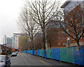
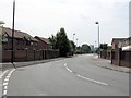
Photos of M5 3NE


Area Information
Living in M5 3NE means inhabiting a tightly packed residential cluster in England, spanning just 5.2 hectares. With a population of 2,138 people, the area is densely populated, at 40,913 people per square kilometre. This small postcode is characterised by its proximity to urban infrastructure, with five metro stations, including Cornbrook and Exchange Quay, and five rail stops such as Salford Crescent. Retail options are abundant, with Co-op Salford and Tesco Salford within reach. The area’s compact size means residents are close to amenities, though the high population density may influence the pace of daily life. Young adults dominate the demographic, with 16% of residents owning their homes. Despite its small footprint, M5 3NE is positioned near major transport routes, including the City Airport Manchester, and offers a mix of retail, leisure, and public transport access. However, the area’s challenges—such as flood risk and crime—require careful consideration for prospective buyers.
- Area Type
- Postcode
- Area Size
- 5.2 hectares
- Population
- 2138
- Population Density
- 8329 people/km²
The property market in M5 3NE is defined by a low home ownership rate—just 16% of residents own their homes. This suggests the area is largely a rental market, with most properties occupied by tenants. The accommodation type is predominantly houses, though the small area size and high population density imply these are likely smaller, possibly terraced or semi-detached homes. For buyers, this means limited opportunities for owner-occupied properties, with competition likely among those seeking short-term or investment properties. The compact nature of the postcode means the immediate surroundings may offer more options, but buyers should consider the area’s constraints, such as flood risk and crime, which could impact property value and desirability. The rental market may cater to students or young professionals, aligning with the area’s youthful demographic.
House Prices in M5 3NE
Showing 94 properties
Energy Efficiency in M5 3NE
Residents of M5 3NE enjoy a range of amenities within practical reach. The area is anchored by five metro stations, including Pomona and Exchange Quay, offering easy access to urban hubs. Retail options are plentiful, with Co-op Salford and Tesco Salford providing grocery and shopping needs. Rail services connect to Salford Crescent and Deansgate stations, facilitating travel to Manchester’s city centre. The nearby City Airport Manchester adds convenience for frequent flyers. Leisure and transport hubs like Cornbrook and Pomona contribute to a lively environment. While the area lacks detailed data on parks or dining, the density of retail and transport options suggests a focus on convenience and connectivity. The mix of metro, rail, and retail amenities creates a dynamic lifestyle, though the absence of specific leisure venues like parks or cafes is notable.
Amenities
Schools
Residents of M5 3NE have access to two primary educational institutions: Ordsall Community Nursery Centre, a nursery school, and St Clement’s Egerton CofE Primary School, a primary school. While no Ofsted ratings are provided, the presence of both nursery and primary schools suggests a focus on early education. For families, this mix offers continuity in schooling for young children, though the absence of secondary schools nearby may require commuting. The area’s young population aligns with the need for early education, but parents seeking comprehensive schooling for older children may need to look beyond M5 3NE. The proximity of these schools to residential properties indicates they are integral to the local community, though their quality and capacity remain unspecified in the data.
| Rank | School | Type | Entry gender | Ages |
|---|
Explore more schools in this area
Go to Schools tabDemographics
M5 3NE has a median age of 22, with the majority of residents aged 15–29. This reflects a youthful, dynamic community, likely centred around students or young professionals. Only 16% of residents own their homes, suggesting a rental-dominated market. The accommodation type is predominantly houses, though the high population density implies these are likely smaller properties. The predominant ethnic group is White, with no specific data on other demographics. The low home ownership rate may indicate a transient population, potentially linked to student housing or temporary employment. For families, the area’s age profile suggests limited demand for larger homes, though the presence of primary schools like St Clement’s Egerton CofE Primary School indicates some family presence. The high proportion of young adults may shape local culture, with social and educational opportunities influencing the area’s character.
Household Size
Accommodation Type
Tenure
Ethnic Group
Religion
Household Composition
Age
Household Deprivation
NS-SEC
Explore more demographic insights in this area
Go to Demographics tabPlanning
Planning Constraints
- Flood RiskPremium
- Ramsar Wetland SitesPremium
- Area of Outstanding Natural BeautyPremium
- Protected Nature ReservePremium
- Protected WoodlandPremium