Area Overview for M35 0JS
Photos of M35 0JS
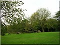


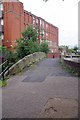
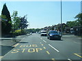
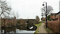
28 photos from this area
Area Information
Key information about the M35 0JS including its size, population, and administrative classification.
- Area Type
- Postcode
- Area Size
- 8478 m²
- Population
- 1486
- Population Density
- 7196 people/km²
House Prices in M35 0JS
32
Properties
£113,020
Average Sold Price
£33,750
Lowest Price
£255,000
Highest Price
Showing 32 properties
| Address | Type | Beds | Baths | Last Sale Price | Last Sale Date | |
|---|---|---|---|---|---|---|
| 29 Farm Street, Failsworth, M35 0JS | Semi-detached | 2 | 1 | £219,950 | Dec 2024 | |
| 5 Farm Street, Failsworth, M35 0JS | Semi-detached | 3 | 2 | £255,000 | Aug 2024 | |
| 51 Farm Street, Failsworth, M35 0JS | house | - | - | £175,000 | Mar 2022 | |
| 27 Farm Street, Failsworth, M35 0JS | house | - | - | £153,000 | Mar 2021 | |
| 21 Farm Street, Failsworth, M35 0JS | Semi-detached | 2 | 1 | £145,000 | Dec 2020 | |
| 53 Farm Street, Failsworth, M35 0JS | house | - | - | £137,500 | Jul 2020 | |
| 17 Farm Street, Failsworth, M35 0JS | Semi-detached | 2 | 2 | £120,000 | Sep 2019 | |
| 7 Farm Street, Failsworth, M35 0JS | house | - | - | £105,275 | Jul 2018 | |
| 63 Farm Street, Failsworth, M35 0JS | house | - | - | £97,500 | Jul 2016 | |
| 23 Farm Street, Failsworth, M35 0JS | Semi-detached | 2 | 1 | £92,500 | Feb 2014 |
Page 1 of 4
Energy Efficiency in M35 0JS
Amenities
Schools
| Rank | School | Type | Entry gender | Ages |
|---|
Explore more schools in this area
Go to Schools tabDemographics
Household Size
Family (3-5 people)
most common
Accommodation Type
Houses
most common
Tenure
66
majority
Ethnic Group
White
most common
Religion
N/A
most common
Household Composition
N/A
most common
Age
47
median
Adults (30-64 years)
most common
Household Deprivation
N/A
with no deprivation
NS-SEC
23
in Lower managerial occupations
Explore more demographic insights in this area
Go to Demographics tabPlanning
Planning Constraints
- Flood RiskPremium
- Ramsar Wetland SitesPremium
- Area of Outstanding Natural BeautyPremium
- Protected Nature ReservePremium
- Protected WoodlandPremium