Area Overview for M35 0NA
Photos of M35 0NA
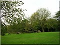


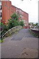
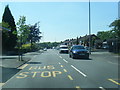
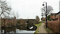
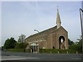

28 photos from this area
Area Information
Key information about the M35 0NA including its size, population, and administrative classification.
- Area Type
- Postcode
- Area Size
- 1.7 hectares
- Population
- 1578
- Population Density
- 3867 people/km²
House Prices in M35 0NA
59
Properties
£140,560
Average Sold Price
£88,000
Lowest Price
£226,600
Highest Price
Showing 59 properties
| Address | Type | Beds | Baths | Last Sale Price | Last Sale Date | |
|---|---|---|---|---|---|---|
| 20 Greaves Avenue, Failsworth, M35 0NA | Semi-detached | 3 | 1 | £226,600 | Sep 2024 | |
| 19 Greaves Avenue, Failsworth, M35 0NA | house | - | - | £160,000 | May 2022 | |
| 24 Greaves Avenue, Failsworth, M35 0NA | house | - | - | £163,500 | Sep 2021 | |
| 11A Greaves Avenue, Failsworth, M35 0NA | Detached | 3 | 1 | £120,000 | Sep 2021 | |
| 8 Greaves Avenue, Failsworth, M35 0NA | house | - | - | £161,000 | Jun 2021 | |
| 62 Greaves Avenue, Failsworth, M35 0NA | house | - | - | £135,000 | Jul 2020 | |
| 54 Greaves Avenue, Failsworth, M35 0NA | house | - | - | £135,000 | Jul 2020 | |
| 52 Greaves Avenue, Failsworth, M35 0NA | house | - | - | £135,000 | Jul 2020 | |
| 48 Greaves Avenue, Failsworth, M35 0NA | house | - | - | £138,000 | Feb 2020 | |
| 60 Greaves Avenue, Failsworth, M35 0NA | house | - | - | £136,000 | Jan 2020 |
Page 1 of 6
Energy Efficiency in M35 0NA
Amenities
Schools
| Rank | School | Type | Entry gender | Ages |
|---|
Explore more schools in this area
Go to Schools tabDemographics
Household Size
One person
most common
Accommodation Type
Houses
most common
Tenure
31
majority
Ethnic Group
White
most common
Religion
N/A
most common
Household Composition
N/A
most common
Age
47
median
Adults (30-64 years)
most common
Household Deprivation
N/A
with no deprivation
NS-SEC
18
in Lower managerial occupations
Explore more demographic insights in this area
Go to Demographics tabPlanning
Planning Constraints
- Flood RiskPremium
- Ramsar Wetland SitesPremium
- Area of Outstanding Natural BeautyPremium
- Protected Nature ReservePremium
- Protected WoodlandPremium