Area Overview for M21 7ND
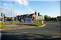
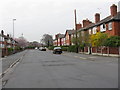
Photos of M21 7ND


Area Information
M21 7ND is a compact residential postcode in England, covering 8,873 square metres and home to 2,009 residents. Its high population density of 226,416 people per square kilometre reflects a tightly knit community, though the area remains small enough to foster familiarity among residents. The median age of 47 suggests a mature demographic, with the majority of residents aged between 30 and 64. This cluster of homes, predominantly owner-occupied, sits at the intersection of practicality and accessibility. Proximity to multiple rail stations, metro lines, and retail hubs ensures daily life is convenient, while broadband scores of 99 and mobile coverage of 85 support seamless connectivity. Schools like Barlow Hall Junior and Infant Schools serve the area, though the presence of a specialist secondary school adds a layer of diversity to the educational landscape. Living here means balancing a compact, high-density environment with the infrastructure of a larger urban area, all within a short walk of amenities.
- Area Type
- Postcode
- Area Size
- 8873 m²
- Population
- 2009
- Population Density
- 2310 people/km²
M21 7ND is characterised by a 53% home ownership rate, with houses making up the majority of the accommodation stock. This indicates a market skewed towards owner-occupied properties rather than rentals, though the small area size and high population density suggest limited housing stock. The concentration of houses may appeal to families seeking space, but the compact nature of the postcode means buyers must consider proximity to surrounding areas for additional options. The high population density, while not uncommon for urban settings, may mean that properties are closely spaced, potentially limiting scope for expansion. For buyers, this area offers a blend of established housing and proximity to amenities, though the small footprint means competition for available homes could be keen.
House Prices in M21 7ND
Showing 23 properties
| Address | Type | Beds | Baths | Last Sale Price | Last Sale Date | |
|---|---|---|---|---|---|---|
| 13 Maitland Avenue, Manchester, M21 7ND | Semi-detached | 3 | 1 | £285,000 | Jul 2021 | |
| 5 Maitland Avenue, Manchester, M21 7ND | Semi-detached | 3 | 1 | £200,000 | Mar 2021 | |
| 15 Maitland Avenue, Manchester, M21 7ND | house | - | - | £325,000 | Mar 2021 | |
| 25 Maitland Avenue, Manchester, M21 7ND | Detached | 3 | 2 | £224,000 | Aug 2014 | |
| 1 Maitland Avenue, Manchester, M21 7ND | house | - | - | £155,000 | Jul 2013 | |
| 43 Maitland Avenue, Manchester, M21 7ND | Terraced | 3 | - | £115,000 | Jul 2013 | |
| 35 Maitland Avenue, Manchester, M21 7ND | house | - | - | £155,000 | Dec 2011 | |
| 41 Maitland Avenue, Manchester, M21 7ND | house | 2 | 1 | £102,000 | Apr 2010 | |
| 39 Maitland Avenue, Manchester, M21 7ND | house | 3 | 1 | £157,000 | Feb 2006 | |
| 23 Maitland Avenue, Manchester, M21 7ND | Semi-detached | - | - | £157,500 | Apr 2004 |
Energy Efficiency in M21 7ND
The lifestyle in M21 7ND is shaped by its proximity to a range of amenities. Retail options include Asda West, Co-op Hardy, and M&S Chorlton-Cum, providing access to groceries, clothing, and general shopping. Metro stations like Barlow Moor Road and St Werburgh’s Road, along with rail services, ensure easy movement around the area. The Chorlton Street Coach Station offers additional transport links, while the three nearby airports cater to frequent travelers. Though no parks or leisure facilities are listed, the density of retail and transport hubs suggests a focus on convenience over expansive green spaces. Daily life here is defined by accessibility, with amenities clustered closely, reducing the need for long commutes. The mix of retail and transport infrastructure supports a practical, urban lifestyle.
Amenities
Schools
Residents of M21 7ND have access to Barlow Hall Junior School and Barlow Hall Infant School, both primary institutions. These schools serve the local community, providing education for younger children. The presence of Manchester Secondary PRU, a specialist provision for students with complex needs, adds a layer of diversity to the educational options. While primary schooling is readily available, families requiring secondary education may need to look beyond the immediate area. The mix of school types suggests a range of educational needs are met, though the PRU’s role implies the area may have a higher proportion of students with additional support requirements. For parents, this means a balance between local primary options and the necessity of commuting for secondary schooling.
| Rank | School | Type | Entry gender | Ages |
|---|
Explore more schools in this area
Go to Schools tabDemographics
The population of M21 7ND is 2,009, with a median age of 47, indicating a community skewed towards middle-aged adults. The most common age range, 30–64 years, suggests a stable demographic with long-term residency. Home ownership stands at 53%, with houses being the primary accommodation type. This contrasts with areas dominated by flats or rental properties, pointing to a preference for private, family-oriented living. The predominant ethnic group is White, though no specific data on diversity or deprivation is provided. The high proportion of adults in the 30–64 bracket may reflect a mix of established families and professionals. With no data on income levels or deprivation, it is unclear how this affects quality of life, but the age profile suggests a community with a strong focus on stability and long-term investment in property.
Household Size
Accommodation Type
Tenure
Ethnic Group
Religion
Household Composition
Age
Household Deprivation
NS-SEC
Explore more demographic insights in this area
Go to Demographics tabPlanning
Planning Constraints
- Flood RiskPremium
- Ramsar Wetland SitesPremium
- Area of Outstanding Natural BeautyPremium
- Protected Nature ReservePremium
- Protected WoodlandPremium