Area Overview for M21 7GL
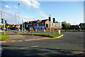
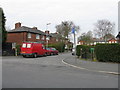
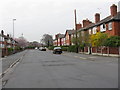
Photos of M21 7GL


Area Information
Living in M21 7GL means inhabiting a compact, densely populated residential cluster in England. The area covers 34.8 hectares and is home to 2,009 residents, translating to a population density of 5,777 people per square kilometre. This makes it a tightly knit community, ideal for those seeking proximity to urban conveniences without the sprawl of larger towns. The area’s small size means amenities and services are closely grouped, reducing travel time for daily needs. While it lacks the sprawling parks or industrial zones of larger cities, its proximity to multiple rail stations, metro stops, and retail hubs ensures a practical, commuter-friendly lifestyle. The demographic profile suggests a mature population, with a median age of 47 and a majority of residents aged 30–64. This hints at a community focused on stability, with a strong presence of owner-occupied homes. For buyers, M21 7GL offers a blend of compact living and urban accessibility, though its high density may appeal more to those prioritising convenience over space.
- Area Type
- Postcode
- Area Size
- 34.8 hectares
- Population
- 2009
- Population Density
- 2310 people/km²
The property market in M21 7GL is characterised by a 53% home ownership rate, indicating a mix of owner-occupied and rental properties. The area’s accommodation type is predominantly houses, which may appeal to buyers seeking standalone homes rather than flats or apartments. This suggests a market skewed towards families or individuals prioritising space and privacy. However, the small area size—just 34.8 hectares—means the housing stock is limited, potentially leading to competition among buyers. The high population density (5,777 people per square kilometre) may also influence property values, with proximity to transport and amenities likely driving demand. For those considering the area, the focus on houses rather than rental properties implies a community more centred on long-term residency than transient populations. Buyers should note the compact nature of the area, which may limit options for those seeking larger properties or suburban settings.
House Prices in M21 7GL
Showing 10 properties
| Address | Type | Beds | Baths | Last Sale Price | Last Sale Date | |
|---|---|---|---|---|---|---|
| 214 Barlow Moor Road, Manchester, M21 7GL | Flat | - | - | - | - | |
| 210 Barlow Moor Road, Manchester, M21 7GL | Semi-detached | - | - | - | - | |
| Non Conformist West Chapel, Southern Cemetery, Barlow Moor Road, Manchester, M21 7GL | commercial | - | - | - | - | |
| Roman Catholic East Chapel, Southern Cemetery, Barlow Moor Road, Manchester, M21 7GL | commercial | - | - | - | - | |
| Church Of England North Chapel, Southern Cemetery, Barlow Moor Road, Manchester, M21 7GL | commercial | - | - | - | - | |
| Jewish Chapel, Southern Cemetery, Barlow Moor Road, Manchester, M21 7GL | commercial | - | - | - | - | |
| Can Shed, Southern Cemetery, Barlow Moor Road, Manchester, M21 7GL | warehouse | - | - | - | - | |
| Rememberance Lodge, Southern Cemetery, Barlow Moor Road, Manchester, M21 7GL | commercial | - | - | - | - | |
| Extension Messroom, Southern Cemetery, Barlow Moor Road, Manchester, M21 7GL | Office | - | - | - | - | |
| Main Messroom, Southern Cemetery, Barlow Moor Road, Manchester, M21 7GL | Office | - | - | - | - |
Energy Efficiency in M21 7GL
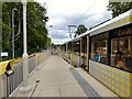
Residents of M21 7GL enjoy a range of amenities within practical reach. The area is served by five metro stations, including Withington and Barlow Moor Road, facilitating easy access to urban centres. Retail options are plentiful, with Co-op Hardy, Asda West, and Co-op West providing everyday shopping needs. Rail stations such as Burnage and East Didsbury offer further connectivity, while the single bus stop at Chorlton Street Coach Station provides additional transport links. Airports are also accessible via Terminal One, Two, and Three Access points, which could be beneficial for frequent flyers. The compact nature of the area means amenities are closely clustered, reducing travel time for errands or leisure. While the data does not specify parks or leisure facilities, the presence of multiple retail and transport hubs suggests a lifestyle focused on convenience and urban accessibility.
Amenities
Schools
Residents of M21 7GL have access to three nearby schools, including Barlow Hall Junior School and Barlow Hall Infant School, both primary institutions. The third is Manchester Secondary PRU, which operates as a special educational needs provision. The presence of two primary schools suggests a focus on early education, though no secondary schools are listed in the data. Families with children may need to look beyond the immediate area for comprehensive secondary education. The mix of school types indicates a range of educational options, though the absence of a traditional secondary school could be a consideration for households planning long-term in the area. The proximity of these schools to residential properties highlights the area’s appeal for families prioritising access to education.
| Rank | School | Type | Entry gender | Ages |
|---|
Explore more schools in this area
Go to Schools tabDemographics
The community in M21 7GL is predominantly composed of adults aged 30–64, with a median age of 47. This suggests a population skewed towards middle-aged individuals, likely reflecting a mix of long-term residents and families. Home ownership stands at 53%, indicating a moderate balance between owner-occupied properties and rental stock. The area’s accommodation is largely houses, which may cater to families or those preferring standalone homes. The predominant ethnic group is White, with no specific data provided on other demographics. The high population density—5,777 people per square kilometre—suggests a compact, possibly urbanised living environment. While no explicit data on deprivation is given, the concentration of retail and transport options implies a level of economic activity. However, the high crime risk score (0/100) may impact quality of life for some residents, particularly those concerned about safety.
Household Size
Accommodation Type
Tenure
Ethnic Group
Religion
Household Composition
Age
Household Deprivation
NS-SEC
Explore more demographic insights in this area
Go to Demographics tabPlanning
Planning Constraints
- Flood RiskPremium
- Ramsar Wetland SitesPremium
- Area of Outstanding Natural BeautyPremium
- Protected Nature ReservePremium
- Protected WoodlandPremium