Area Overview for M21 0BW
Photos of M21 0BW
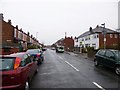
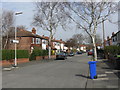
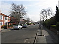
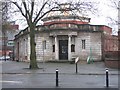
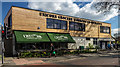
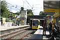
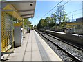
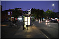
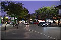
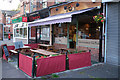
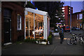
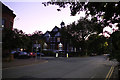
70 photos from this area
Area Information
Key information about the M21 0BW including its size, population, and administrative classification.
- Area Type
- Postcode
- Area Size
- 6188 m²
- Population
- 1696
- Population Density
- 6914 people/km²
House Prices in M21 0BW
64
Properties
£235,665
Average Sold Price
£43,000
Lowest Price
£525,000
Highest Price
Showing 64 properties
| Address | Type | Beds | Baths | Last Sale Price | Last Sale Date | |
|---|---|---|---|---|---|---|
| 70 Keppel Road, Manchester, M21 0BW | house | - | - | £525,000 | May 2021 | |
| 64 Keppel Road, Manchester, M21 0BW | Semi-detached | 5 | 2 | £510,000 | Aug 2017 | |
| 28 Keppel Road, Manchester, M21 0BW | house | - | - | £382,000 | Jul 2016 | |
| 34 Keppel Road, Manchester, M21 0BW | house | 1 | - | £215,000 | Jun 2011 | |
| 36 Keppel Road, Manchester, M21 0BW | house | - | - | £300,000 | Jan 2011 | |
| 30 Keppel Road, Manchester, M21 0BW | Terraced | 6 | 2 | £111,316 | Jan 2009 | |
| 66 Keppel Road, Manchester, M21 0BW | Semi-detached | 1 | 1 | £290,000 | Jan 2008 | |
| 58 Keppel Road, Manchester, M21 0BW | house | - | - | £225,000 | Oct 2004 | |
| 50 Keppel Road, Manchester, M21 0BW | Terraced | 8 | 5 | £298,000 | Jul 2004 | |
| 62 Keppel Road, Manchester, M21 0BW | house | 1 | 1 | £170,000 | Sep 2002 |
Page 1 of 7
Energy Efficiency in M21 0BW
Amenities
Schools
| Rank | School | Type | Entry gender | Ages |
|---|
Explore more schools in this area
Go to Schools tabDemographics
Household Size
One person
most common
Accommodation Type
Flats
most common
Tenure
27
majority
Ethnic Group
White
most common
Religion
N/A
most common
Household Composition
N/A
most common
Age
47
median
Adults (30-64 years)
most common
Household Deprivation
N/A
with no deprivation
NS-SEC
53
in Lower managerial occupations
Explore more demographic insights in this area
Go to Demographics tabPlanning
Planning Constraints
- Flood RiskPremium
- Ramsar Wetland SitesPremium
- Area of Outstanding Natural BeautyPremium
- Protected Nature ReservePremium
- Protected WoodlandPremium