Area Overview for M21 0BH
Photos of M21 0BH
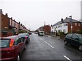
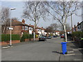
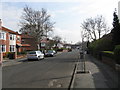
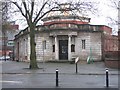

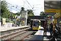
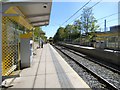
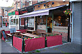
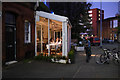
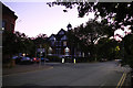
70 photos from this area
Area Information
Key information about the M21 0BH including its size, population, and administrative classification.
- Area Type
- Postcode
- Area Size
- 5926 m²
- Population
- 1610
- Population Density
- 6545 people/km²
House Prices in M21 0BH
53
Properties
£220,066
Average Sold Price
£42,000
Lowest Price
£430,000
Highest Price
Showing 53 properties
| Address | Type | Beds | Baths | Last Sale Price | Last Sale Date | |
|---|---|---|---|---|---|---|
| 71 Albany Road, Manchester, M21 0BH | Semi-detached | - | - | £375,000 | Apr 2024 | |
| 31 Albany Road, Manchester, M21 0BH | house | - | - | £362,037 | Aug 2019 | |
| 49 Albany Road, Manchester, M21 0BH | house | - | - | £430,000 | May 2017 | |
| 35 Albany Road, Manchester, M21 0BH | Semi-detached | 6 | 3 | £280,000 | Mar 2014 | |
| 43 Albany Road, Manchester, M21 0BH | house | - | - | £250,000 | Sep 2012 | |
| 61 Albany Road, Manchester, M21 0BH | house | - | - | £350,000 | Oct 2007 | |
| 59 Albany Road, Manchester, M21 0BH | house | - | - | £215,000 | Oct 2003 | |
| 45 Albany Road, Manchester, M21 0BH | house | 6 | 2 | £155,000 | Dec 2002 | |
| 63 Albany Road, Manchester, M21 0BH | house | 1 | - | £64,000 | Aug 1999 | |
| 29 Albany Road, Manchester, M21 0BH | Flat | 2 | 2 | £62,750 | Nov 1997 |
Page 1 of 6
Energy Efficiency in M21 0BH
Amenities
Schools
| Rank | School | Type | Entry gender | Ages |
|---|
Explore more schools in this area
Go to Schools tabDemographics
Household Size
Family (3-5 people)
most common
Accommodation Type
Houses
most common
Tenure
67
majority
Ethnic Group
White
most common
Religion
N/A
most common
Household Composition
N/A
most common
Age
47
median
Adults (30-64 years)
most common
Household Deprivation
N/A
with no deprivation
NS-SEC
56
in Lower managerial occupations
Explore more demographic insights in this area
Go to Demographics tabPlanning
Planning Constraints
- Flood RiskPremium
- Ramsar Wetland SitesPremium
- Area of Outstanding Natural BeautyPremium
- Protected Nature ReservePremium
- Protected WoodlandPremium