Area Overview for M21 0AX
Photos of M21 0AX
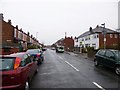
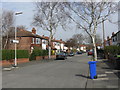
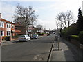


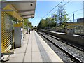

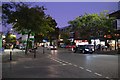
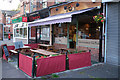


70 photos from this area
Area Information
Key information about the M21 0AX including its size, population, and administrative classification.
- Area Type
- Postcode
- Area Size
- 3148 m²
- Population
- 1696
- Population Density
- 6914 people/km²
House Prices in M21 0AX
29
Properties
£336,490
Average Sold Price
£41,500
Lowest Price
£515,000
Highest Price
Showing 29 properties
| Address | Type | Beds | Baths | Last Sale Price | Last Sale Date | |
|---|---|---|---|---|---|---|
| 36 Warwick Road, Manchester, M21 0AX | Terraced | 4 | 2 | £500,000 | Feb 2024 | |
| 21 Warwick Road, Manchester, M21 0AX | Terraced | 4 | 2 | £450,000 | May 2023 | |
| 28 Warwick Road, Manchester, M21 0AX | Terraced | 4 | 1 | £515,000 | Sep 2021 | |
| 25 Warwick Road, Manchester, M21 0AX | house | - | - | £445,000 | Oct 2018 | |
| 26 Warwick Road, Manchester, M21 0AX | Semi-detached | 3 | 1 | £335,000 | Jul 2014 | |
| 30 Warwick Road, Manchester, M21 0AX | house | - | - | £325,775 | Nov 2013 | |
| 32 Warwick Road, Manchester, M21 0AX | house | - | - | £297,600 | Sep 2013 | |
| 23 Warwick Road, Manchester, M21 0AX | house | 4 | 1 | £245,000 | Aug 2013 | |
| 31 Warwick Road, Manchester, M21 0AX | house | - | - | £260,000 | Mar 2010 | |
| 24 Warwick Road, Manchester, M21 0AX | Terraced | - | - | £375,000 | Sep 2009 |
Page 1 of 3
Energy Efficiency in M21 0AX
Amenities
Schools
| Rank | School | Type | Entry gender | Ages |
|---|
Explore more schools in this area
Go to Schools tabDemographics
Household Size
One person
most common
Accommodation Type
Flats
most common
Tenure
27
majority
Ethnic Group
White
most common
Religion
N/A
most common
Household Composition
N/A
most common
Age
47
median
Adults (30-64 years)
most common
Household Deprivation
N/A
with no deprivation
NS-SEC
53
in Lower managerial occupations
Explore more demographic insights in this area
Go to Demographics tabPlanning
Planning Constraints
- Flood RiskPremium
- Ramsar Wetland SitesPremium
- Area of Outstanding Natural BeautyPremium
- Protected Nature ReservePremium
- Protected WoodlandPremium