Area Overview for Up Holland
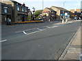
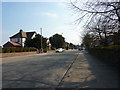
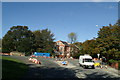
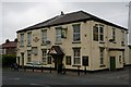
Photos of Up Holland


Area Information
Up Holland is a defined district borough unitary ward located in England, covering an area of 15.0 km². You will find 1,452 residents calling this compact space home, resulting in a population density of 97 people per square kilometre. The location offers a low-density living environment where space is ample and the community remains tightly knit. Residents here enjoy the benefits of a rural setting without complete isolation, as digital infrastructure supports modern needs. The area size allows for a spread-out layout typical of home regions in Warrington. You can expect a quiet lifestyle where neighbours know each other well. This ward provides housing options suitable for those seeking peace rather than the pace of city centre life. The combination of limited population and significant land area creates a distinct character separate from high-density suburbs. Families and retirees alike find the scale of Up Holland manageable and serene.
- Area Type
- Parish
- Area Size
- 15.0 km²
- Population
- 1452
- Population Density
- 97 people/km²
Demographics
The community profile in Up Holland reveals a population heavily skewed towards older residents. The median age sits at 70 years, making this one of the areas around Warrington with the oldest demographic. Most households are occupied by people in total age categories, indicating that single-person homes or couples without children dominate the scene. You are three times more likely to purchase your own home than to rent in this ward. Home ownership stands at 83%, a figure higher than the national average for the United Kingdom. This high level of tenure suggests long-term stability and residents who have invested in their localities. The accommodation types reflect this trend, with the total household data showing a lack of transient renting blocks. There is no shortage of privacy or settled neighbours in Up Holland. Home buyers should be aware that resale markets may move slower due to the lack of young professionals.
Household Size
Accommodation Type
Tenure
Ethnic Group
Religion
Household Composition
Age
Household Deprivation
NS-SEC
Explore more demographic insights in this area
Go to Demographics tabPlanning
Planning Constraints
- Flood RiskPremium
- Ramsar Wetland SitesPremium
- Area of Outstanding Natural BeautyPremium
- Protected Nature ReservePremium
- Protected WoodlandPremium