Area Overview for Orrell
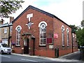
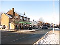
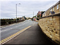
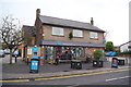
Photos of Orrell


Area Information
Living in Orrell offers a distinct experience within the wider built-up area structure of Greater Manchester. This locality covers a total area of 5.7 km², providing a compact yet established setting for residents. As a built-up town, it sits comfortably between larger urban centres, allowing families and individuals to enjoy a settled life without being completely isolated from the city. Daily life here is defined by proximity to key transport links and local retail hubs, ensuring that essential errands are manageable without requiring a long journey. The population reflects a community that has been established for some time, with evidence of stability found in the high rate of home ownership. You can expect a neighbourhood where the pace of life is generally slower than in major metropolitan cores. The layout supports a mix of housing that caters to those seeking space and quiet, distinct from the denser blocks of a city centre. Access to rail stations like Orrell Railway Station places you within practical reach of Wigan and Manchester, making this a viable option for commuters who value travel time. Schools such as Orrell Newfold Community Primary School are situated nearby, indicating that family life is a central part of the local character. The area combines the convenience of town living with the relative tranquillity of a residential district. Living in Orrell means accessing a place where the infrastructure supports a standard lifestyle without the congestion of major urban thoroughfares.
- Area Type
- Built Up Area 250
- Area Size
- 5.7 km²
- Population
- Not available
- Population Density
- Not available
Amenities
Schools
Families considering Orrell have access to a range of educational institutions within practical reaching distance. The area boasts several primary schools, including Orrell Holgate Primary School, Lamberhead Green Junior School, and Lamberhead Green Infant School. Of particular note is Orrell Newfold Community Primary School, which holds an outstanding Ofsted rating, a testament to the high quality of education provided there. Another option, St James' Catholic Primary School Orrell, carries a good Ofsted rating, offering a religious education alternative. This selection of schools covers both secular and faith-based options, allowing parents to choose according to their beliefs or preferences for curriculum style. The presence of these specific schools supports the demographic reality of an area with a median age of 70, suggesting that parents are well-represented in the community. While you will not find secondary schools listed in the immediate vicinity in the provided data, the quality of local primary education is evident in the Ofsted achievements. For those working from home who need the residence close to good schools, Orrell provides a viable solution. Schools near Orrell are situated within the built-up area, ensuring that drop-offs and pickups do not contribute to significant traffic delays compared to suburban locations. The mix of outstanding and good ratings indicates a generally high standard of education available to children growing up in this locality.
| Rank | School | Type | Entry gender | Ages |
|---|
Explore more schools in this area
Go to Schools tabDemographics
The community in Orrell presents a clear demographic profile characterised by a relatively older population structure. The median age stands at 70 years, which is notably higher than the national average for many English towns. This figure suggests that the area contains a significant number of pensioners and older adults who have chosen to make their home here. Accommodation statistics reinforce this picture, showing a strong preference for settled living over transient arrangements. With 72% of homes owner-occupied, the neighbourhood is predominantly a community of residents who have invested in properties for the long term. This high ownership rate often correlates with stability and deeper local knowledge among the neighbours. Household composition data indicates that many families and individuals have established roots in Orrell rather than renting temporarily. The age concentration means that services and social groups often cater to mature residents. While the data does not specify the exact number of younger adults, the overall trend points towards an area where life expectancy or retirement age plays a role in population distribution. Living in Orrell involves being part of a populace where the median age of 70 creates a specific social atmosphere. This demographic reality can affect local businesses, as they may focus on goods and services relevant to older adults, such as healthcare support or quiet leisure activities. Understanding this age profile helps you assess whether the community aligns with your personal lifestyle expectations.