Area Overview for L15 9HN
Photos of L15 9HN
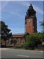
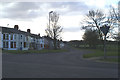
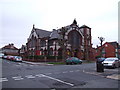
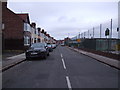
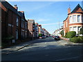

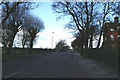
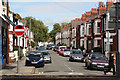
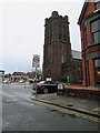
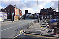
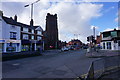
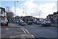
68 photos from this area
Area Information
Key information about the L15 9HN including its size, population, and administrative classification.
- Area Type
- Postcode
- Area Size
- 4675 m²
- Population
- 1579
- Population Density
- 4354 people/km²
House Prices in L15 9HN
41
Properties
£173,557
Average Sold Price
£57,750
Lowest Price
£295,000
Highest Price
Showing 41 properties
| Address | Type | Beds | Baths | Last Sale Price | Last Sale Date | |
|---|---|---|---|---|---|---|
| 27 Peterborough Road, Liverpool, L15 9HN | house | 4 | 1 | £295,000 | May 2024 | |
| 21 Peterborough Road, Liverpool, L15 9HN | house | - | - | £180,000 | Sep 2021 | |
| 20 Peterborough Road, Liverpool, L15 9HN | Terraced | 4 | 1 | £252,000 | Mar 2021 | |
| 11 Peterborough Road, Liverpool, L15 9HN | Terraced | 4 | - | £240,000 | Jan 2021 | |
| 19 Peterborough Road, Liverpool, L15 9HN | Terraced | 1 | - | £245,000 | Oct 2020 | |
| 10 Peterborough Road, Liverpool, L15 9HN | Terraced | 4 | 1 | £260,000 | Aug 2020 | |
| 8 Peterborough Road, Liverpool, L15 9HN | Terraced | 4 | 1 | £240,000 | Feb 2020 | |
| 30 Peterborough Road, Liverpool, L15 9HN | house | 4 | - | £197,000 | Nov 2016 | |
| 22 Peterborough Road, Liverpool, L15 9HN | Terraced | - | - | £192,500 | Aug 2006 | |
| 26 Peterborough Road, Liverpool, L15 9HN | Terraced | - | - | £170,000 | Oct 2005 |
Page 1 of 5
Energy Efficiency in L15 9HN
Amenities
Schools
| Rank | School | Type | Entry gender | Ages |
|---|
Explore more schools in this area
Go to Schools tabDemographics
Household Size
One person
most common
Accommodation Type
Houses
most common
Tenure
62
majority
Ethnic Group
White
most common
Religion
N/A
most common
Household Composition
N/A
most common
Age
47
median
Adults (30-64 years)
most common
Household Deprivation
N/A
with no deprivation
NS-SEC
39
in Lower managerial occupations
Explore more demographic insights in this area
Go to Demographics tabPlanning
Planning Constraints
- Flood RiskPremium
- Ramsar Wetland SitesPremium
- Area of Outstanding Natural BeautyPremium
- Protected Nature ReservePremium
- Protected WoodlandPremium