Area Overview for L15 9JB
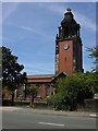
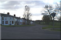
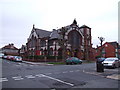
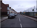
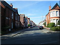
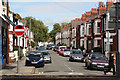
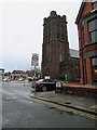
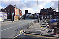
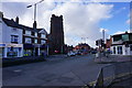
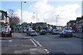
Photos of L15 9JB


Area Information
Living in L15 9JB means inhabiting a small, tightly knit residential cluster in England, home to 1,579 residents. The area’s compact nature fosters a quiet, community-oriented atmosphere, with a median age of 47 and a population skewed toward adults aged 30–64. This suggests a stable, mature demographic, likely with established careers and families. The area’s housing stock is predominantly owner-occupied, with 62% of homes owned outright, indicating a sense of permanence. Daily life here balances proximity to essential services with a low-key, residential character. Residents benefit from excellent broadband connectivity, scoring 99 out of 100, ensuring seamless digital access for work or leisure. Nearby, a mix of primary schools, including the Ofsted-rated ‘good’ Wavertree Church of England School and The Blue Coat School, cater to local children. The area’s practical reach includes rail stations, ferry terminals, and two airports, offering diverse transport options. While crime risk is medium, standard precautions suffice. L15 9JB’s blend of residential calm and accessible amenities makes it appealing for those seeking a balanced lifestyle.
- Area Type
- Postcode
- Area Size
- Not available
- Population
- 1579
- Population Density
- 4354 people/km²
The property market in L15 9JB is dominated by owner-occupied homes, with 62% of properties owned outright. This high rate of home ownership suggests a stable market with limited rental activity, potentially offering buyers a sense of security in a small, defined area. The accommodation type is predominantly houses, which may appeal to families seeking space and privacy. Given the area’s small size, the housing stock is likely limited, making it a niche market for those prioritising residential tranquillity over urban density. Buyers should consider that the proximity to schools, transport, and amenities may enhance property value, though the compact nature of the area means competition for available homes could be fierce. The mix of houses and the focus on owner-occupation indicate a community where long-term residency is common, which may influence both property prices and local dynamics.
House Prices in L15 9JB
No properties found in this postcode.
Energy Efficiency in L15 9JB
The lifestyle in L15 9JB is shaped by its proximity to a range of amenities. Retail options include Tesco Allerton, Asda Penny, and Iceland Penny, providing everyday shopping needs within reach. Rail stations like Mossley Hill and Broad Green offer easy access to public transport, while ferry terminals at Liverpool Pier Head and Woodside Birkenhead connect residents to water-based travel. The area’s two airports, both Liverpool John Lennon Airport, cater to those requiring air travel. Though the data does not mention parks or leisure facilities directly, the presence of schools and transport hubs suggests a balance between residential comfort and practicality. The mix of retail, transport, and travel options ensures daily life is convenient, with minimal need to travel far for essentials. The area’s character is defined by its accessibility and the ease with which residents can navigate between home, work, and leisure.
Amenities
Schools
Residents of L15 9JB have access to a range of educational institutions, including Wavertree Church of England School, a primary school with an Ofsted rating of ‘good’, and The Blue Coat School, which operates as both a primary school and an academy with the same ‘good’ rating. The Royal School for the Blind (Liverpool), a special school, also serves the area, highlighting a commitment to inclusive education. This mix of school types ensures families have options for both mainstream and specialist education. The presence of two primary schools within the area, alongside a special school, suggests a well-rounded educational infrastructure. For parents, the ‘good’ Ofsted ratings indicate reliable standards, though the absence of secondary schools means students may need to travel for further education. The variety of schools reflects the area’s dedication to meeting diverse educational needs, from early years to specialist support.
| Rank | School | Type | Entry gender | Ages |
|---|
Explore more schools in this area
Go to Schools tabDemographics
The community in L15 9JB is predominantly composed of adults aged 30–64, with a median age of 47. This suggests a population largely in their prime working years, likely with established careers and families. Home ownership is strong, with 62% of residents owning their homes, reflecting a stable, long-term presence in the area. The accommodation type is primarily houses, which may indicate a preference for family-friendly living spaces. The predominant ethnic group is White, though no specific data on diversity or deprivation is provided. The age profile and ownership figures suggest a mature, settled community with limited turnover. This demographic structure likely influences local services and amenities, which are tailored to the needs of adults and families. The absence of detailed diversity metrics means the area’s cultural makeup remains less defined in the data, but the focus on houses and owner-occupation points to a traditional, residential character.
Household Size
Accommodation Type
Tenure
Ethnic Group
Religion
Household Composition
Age
Household Deprivation
NS-SEC
Explore more demographic insights in this area
Go to Demographics tabPlanning
Planning Constraints
- Flood RiskPremium
- Ramsar Wetland SitesPremium
- Area of Outstanding Natural BeautyPremium
- Protected Nature ReservePremium
- Protected WoodlandPremium