Area Overview for L15 9JD
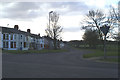
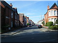
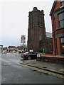
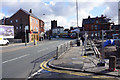
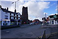
Photos of L15 9JD


Area Information
Living in L15 9JD means being part of a small, tightly knit residential cluster in England, home to 1,579 residents. The area is defined by its compact footprint and proximity to essential services, making it practical for daily life. Its modest size fosters a sense of familiarity, with residents likely to know their neighbours. The community is anchored by a mix of local amenities, from retail outlets to transport hubs, ensuring convenience for families and commuters. While not a sprawling suburb, L15 9JD offers a balance of residential tranquillity and access to urban infrastructure. Its location near major transport routes and educational institutions suggests it caters to a range of household needs, from young families to professionals seeking proximity to work. The area’s character is shaped by its demographics, with a median age of 47 and a population skewed toward adults aged 30–64, reflecting a stable, established community. For buyers, this postcode represents a focused, self-contained environment where practicality and accessibility are prioritised.
- Area Type
- Postcode
- Area Size
- Not available
- Population
- 1579
- Population Density
- 4354 people/km²
The property market in L15 9JD is dominated by owner-occupied homes, with 62% of residents living in properties they own. This contrasts with rental markets where private landlords predominate, suggesting a community of long-term residents who have invested in their homes. The accommodation type is primarily houses, which aligns with the area’s focus on family living and space. For buyers, this means a market where properties are likely to be larger and more traditional than in high-density areas. The small size of the postcode implies limited housing stock, so opportunities for purchase may be constrained to specific locations within the cluster. The high home ownership rate also indicates strong local demand, which could influence property values. Buyers should consider the area’s compact nature, as expansion or development options may be limited by its size and existing infrastructure.
House Prices in L15 9JD
No properties found in this postcode.
Energy Efficiency in L15 9JD
Daily life in L15 9JD is supported by a range of nearby amenities, including retail outlets like Tesco Allerton, Asda Penny, and Iceland Penny, which cater to everyday shopping needs. The area’s rail network, with stations such as Mossley Hill and Broad Green, facilitates easy travel to work or leisure. Ferry terminals, including Liverpool Pier Head and Woodside Birkenhead, provide access to water-based transport, while proximity to Liverpool John Lennon Airport ensures regional and international connectivity. The presence of multiple retail and transport hubs suggests a practical, service-oriented lifestyle, where residents can access essentials without long commutes. The mix of retail, transport, and travel options contributes to a convenient, well-served environment that balances local convenience with broader mobility.
Amenities
Schools
Residents of L15 9JD have access to a range of educational institutions, including primary schools and a special needs school. Wavertree Church of England School and The Blue Coat School (rated ‘good’ by Ofsted) provide primary education, while The Blue Coat School also operates as an academy with the same rating. The Royal School for the Blind (Liverpool) serves students with specific needs, offering a vital resource for families. This mix of school types ensures that both mainstream and specialist education is available within reach. The presence of two ‘good’-rated primary schools suggests a strong foundation for early education, though the absence of secondary schools may require families to travel further for higher-level education. The variety of institutions reflects the area’s commitment to meeting diverse educational requirements, from general learning to specialist support.
| Rank | School | Type | Entry gender | Ages |
|---|
Explore more schools in this area
Go to Schools tabDemographics
The population of L15 9JD is predominantly adults aged 30–64, with a median age of 47. This suggests a mature, settled community with a strong presence of middle-aged households. Home ownership is high, at 62%, indicating a stable residential market where many residents are long-term property holders. The area is characterised by houses rather than flats, aligning with the preference for family-oriented living. The predominant ethnic group is White, reflecting the broader demographic trends in the region. While no specific data on deprivation is provided, the high home ownership rate and age profile suggest a relatively stable economic environment. The absence of detailed diversity metrics means the community’s cultural composition remains less defined in the data, but the presence of multiple schools, including special needs institutions, hints at a need for varied educational provision.
Household Size
Accommodation Type
Tenure
Ethnic Group
Religion
Household Composition
Age
Household Deprivation
NS-SEC
Explore more demographic insights in this area
Go to Demographics tabPlanning
Planning Constraints
- Flood RiskPremium
- Ramsar Wetland SitesPremium
- Area of Outstanding Natural BeautyPremium
- Protected Nature ReservePremium
- Protected WoodlandPremium