Area Overview for L15 9EU
Photos of L15 9EU
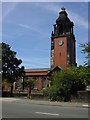
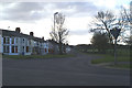
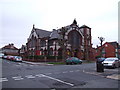
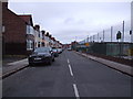
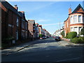

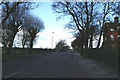
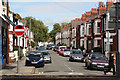
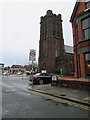
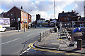
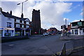
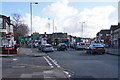
68 photos from this area
Area Information
Key information about the L15 9EU including its size, population, and administrative classification.
- Area Type
- Postcode
- Area Size
- 7575 m²
- Population
- 1577
- Population Density
- 5909 people/km²
House Prices in L15 9EU
35
Properties
£258,412
Average Sold Price
£69,000
Lowest Price
£420,000
Highest Price
Showing 35 properties
| Address | Type | Beds | Baths | Last Sale Price | Last Sale Date | |
|---|---|---|---|---|---|---|
| 39 Heathfield Road, Liverpool, L15 9EU | Terraced | 4 | 2 | £420,000 | Aug 2024 | |
| 17 Heathfield Road, Liverpool, L15 9EU | Terraced | 5 | 2 | £410,000 | Dec 2023 | |
| 53 Heathfield Road, Liverpool, L15 9EU | Terraced | 4 | - | £387,000 | May 2023 | |
| 55 Heathfield Road, Liverpool, L15 9EU | Terraced | 4 | 1 | £342,000 | Mar 2022 | |
| 47 Heathfield Road, Liverpool, L15 9EU | house | - | - | £365,000 | Jun 2021 | |
| 57 Heathfield Road, Liverpool, L15 9EU | Terraced | 4 | 2 | £295,000 | Mar 2021 | |
| 23 Heathfield Road, Liverpool, L15 9EU | Terraced | 4 | 1 | £287,000 | Feb 2020 | |
| 45 Heathfield Road, Liverpool, L15 9EU | Terraced | 4 | 1 | £255,000 | Dec 2017 | |
| 41 Heathfield Road, Liverpool, L15 9EU | Terraced | 4 | 2 | £264,000 | Nov 2016 | |
| 25 Heathfield Road, Liverpool, L15 9EU | Flat | - | - | £90,000 | Sep 2016 |
Page 1 of 4
Energy Efficiency in L15 9EU
Amenities
Schools
| Rank | School | Type | Entry gender | Ages |
|---|
Explore more schools in this area
Go to Schools tabDemographics
Household Size
Two person
most common
Accommodation Type
Houses
most common
Tenure
65
majority
Ethnic Group
White
most common
Religion
N/A
most common
Household Composition
N/A
most common
Age
47
median
Adults (30-64 years)
most common
Household Deprivation
N/A
with no deprivation
NS-SEC
41
in Lower managerial occupations
Explore more demographic insights in this area
Go to Demographics tabPlanning
Planning Constraints
- Flood RiskPremium
- Ramsar Wetland SitesPremium
- Area of Outstanding Natural BeautyPremium
- Protected Nature ReservePremium
- Protected WoodlandPremium