Area Overview for L18 0HL
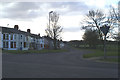
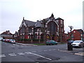
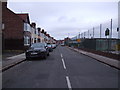
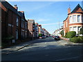
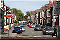
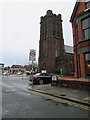
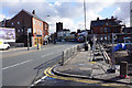
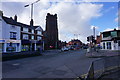
Photos of L18 0HL


Area Information
Living in L18 0HL means inhabiting a compact, residential postcode area in England, covering just 1036 square metres. Despite its small size, this area is densely populated, with 1496 residents packed into a space that supports a tight-knit community. The high population density of 1.4 million people per square kilometre reflects a focus on housing rather than open space. Daily life here is characterised by proximity to essential services and transport links, with residents enjoying a mix of retail, rail, and ferry access. The area’s compact nature means most amenities are within walking distance, though its size also limits expansion. L18 0HL is not a sprawling suburb but a concentrated cluster of homes, predominantly houses, which suggests a stable, long-term residential demographic. The low flood risk and below-average crime rates further reinforce its appeal as a secure, if densely populated, place to live. For those seeking a balance between urban convenience and safety, this postcode offers a distinct blend of practicality and proximity to key infrastructure.
- Area Type
- Postcode
- Area Size
- 1036 m²
- Population
- 1496
- Population Density
- 8030 people/km²
The property market in L18 0HL is defined by high home ownership (77%) and a focus on houses rather than flats. This suggests a market dominated by owner-occupied properties, likely attracting families and professionals seeking stable, long-term housing. The small area size means the housing stock is limited, but the concentration of houses implies a traditional, possibly older, built environment. Buyers should consider that the area’s compact nature may restrict availability, though the high ownership rate indicates strong demand from existing residents. The absence of rental properties or newer developments suggests a conservative market, where properties are likely to be well-maintained but with limited scope for redevelopment. For those seeking a home in this postcode, the emphasis on houses means buyers should prioritise properties that meet their specific needs, as the market is not geared towards high turnover or speculative investment.
House Prices in L18 0HL
No properties found in this postcode.
Energy Efficiency in L18 0HL
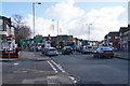
Life in L18 0HL is supported by a range of nearby amenities within practical reach. Retail options include major chains such as Tesco Allerton, Iceland Penny, and Asda Penny, ensuring everyday shopping needs are met without the need to travel far. The area’s rail network is extensive, with stations like Mossley Hill and Wavertree Technology Park offering links to employment centres and cultural hubs. Ferry terminals at Liverpool Pier Head and Woodside Birkenhead provide access to maritime travel, while proximity to Liverpool John Lennon Airport caters to those requiring frequent air travel. These amenities contribute to a convenient lifestyle, where residents can balance local convenience with regional connectivity. The presence of multiple transport options and retail outlets suggests a community prioritising accessibility, though the small area size means these services are concentrated rather than spread out.
Amenities
Schools
| Rank | School | Type | Entry gender | Ages |
|---|
Explore more schools in this area
Go to Schools tabDemographics
The community in L18 0HL is predominantly middle-aged, with a median age of 47 and the majority of residents falling within the 30-64 age range. This suggests a population skewed towards established adults, likely including families and professionals. Home ownership is high at 77%, indicating a strong presence of long-term residents rather than renters. The area is composed almost entirely of houses, not flats, which aligns with the demographic profile of older, more settled households. The predominant ethnic group is White, though no further breakdown of diversity is provided. The high home ownership rate and age distribution point to a community that values stability and permanence. With no data on deprivation levels, it is unclear how economic pressures might affect quality of life, but the low crime score of 88 suggests a generally secure environment. This combination of factors paints a picture of a mature, self-sufficient neighbourhood with minimal turnover of residents.
Household Size
Accommodation Type
Tenure
Ethnic Group
Religion
Household Composition
Age
Household Deprivation
NS-SEC
Explore more demographic insights in this area
Go to Demographics tabPlanning
Planning Constraints
- Flood RiskPremium
- Ramsar Wetland SitesPremium
- Area of Outstanding Natural BeautyPremium
- Protected Nature ReservePremium
- Protected WoodlandPremium