Area Overview for L15 3HF
Photos of L15 3HF
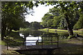
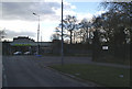
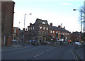
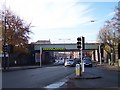
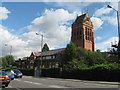
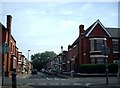
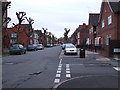
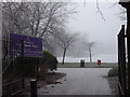
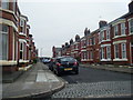
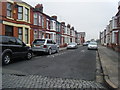
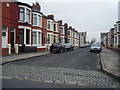
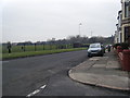
50 photos from this area
Area Information
Key information about the L15 3HF including its size, population, and administrative classification.
- Area Type
- Postcode
- Area Size
- 9365 m²
- Population
- 1587
- Population Density
- 5650 people/km²
House Prices in L15 3HF
67
Properties
£129,726
Average Sold Price
£27,500
Lowest Price
£233,500
Highest Price
Showing 67 properties
| Address | Type | Beds | Baths | Last Sale Price | Last Sale Date | |
|---|---|---|---|---|---|---|
| 97 Avondale Road, Liverpool, L15 3HF | Terraced | 4 | 2 | £215,000 | Jun 2025 | |
| 77 Avondale Road, Liverpool, L15 3HF | Terraced | 3 | 1 | £205,000 | Mar 2025 | |
| 82 Avondale Road, Liverpool, L15 3HF | Terraced | 4 | - | £215,000 | Nov 2024 | |
| 71 Avondale Road, Liverpool, L15 3HF | house | 3 | 1 | £225,000 | Apr 2024 | |
| 118 Avondale Road, Liverpool, L15 3HF | Terraced | 3 | 1 | £190,000 | Jan 2024 | |
| 103 Avondale Road, Liverpool, L15 3HF | Terraced | 3 | 1 | £204,000 | Jan 2024 | |
| 86 Avondale Road, Liverpool, L15 3HF | Terraced | 3 | - | £233,500 | May 2023 | |
| 94 Avondale Road, Liverpool, L15 3HF | house | 3 | 1 | £205,000 | May 2023 | |
| 96 Avondale Road, Liverpool, L15 3HF | house | 3 | 1 | £180,000 | Sep 2022 | |
| 72 Avondale Road, Liverpool, L15 3HF | house | - | - | £144,000 | Aug 2021 |
Page 1 of 7
Energy Efficiency in L15 3HF
Amenities
Schools
| Rank | School | Type | Entry gender | Ages |
|---|
Explore more schools in this area
Go to Schools tabDemographics
Household Size
Family (3-5 people)
most common
Accommodation Type
Houses
most common
Tenure
48
majority
Ethnic Group
White
most common
Religion
N/A
most common
Household Composition
N/A
most common
Age
22
median
Young Adults (15-29 years)
most common
Household Deprivation
N/A
with no deprivation
NS-SEC
17
in Lower managerial occupations
Explore more demographic insights in this area
Go to Demographics tabPlanning
Planning Constraints
- Flood RiskPremium
- Ramsar Wetland SitesPremium
- Area of Outstanding Natural BeautyPremium
- Protected Nature ReservePremium
- Protected WoodlandPremium