Area Overview for L15 3HN
Photos of L15 3HN
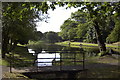
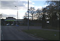
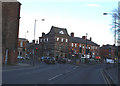
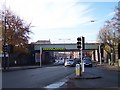
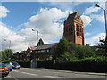
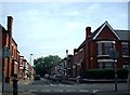
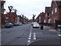
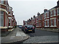
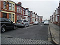
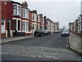
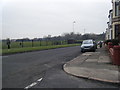
50 photos from this area
Area Information
Key information about the L15 3HN including its size, population, and administrative classification.
- Area Type
- Postcode
- Area Size
- 5424 m²
- Population
- 1587
- Population Density
- 5650 people/km²
House Prices in L15 3HN
23
Properties
£123,856
Average Sold Price
£33,750
Lowest Price
£230,000
Highest Price
Showing 23 properties
| Address | Type | Beds | Baths | Last Sale Price | Last Sale Date | |
|---|---|---|---|---|---|---|
| 49 Garmoyle Road, Liverpool, L15 3HN | Terraced | 3 | 1 | £175,000 | May 2025 | |
| 45 Garmoyle Road, Liverpool, L15 3HN | house | - | - | £200,000 | Jul 2024 | |
| 39 Garmoyle Road, Liverpool, L15 3HN | Terraced | 3 | - | £230,000 | Nov 2023 | |
| 21 Garmoyle Road, Liverpool, L15 3HN | house | - | - | £95,000 | May 2020 | |
| 25 Garmoyle Road, Liverpool, L15 3HN | house | - | - | £150,000 | Mar 2020 | |
| 33 GARMOYLE ROAD, Liverpool, L15 3HN | Detached | - | - | £192,500 | Jun 2019 | |
| 15 Garmoyle Road, Liverpool, L15 3HN | Terraced | 3 | 1 | £112,000 | Oct 2017 | |
| 51 Garmoyle Road, Liverpool, L15 3HN | Terraced | 4 | 1 | £142,500 | Apr 2017 | |
| 23 Garmoyle Road, Liverpool, L15 3HN | Terraced | 7 | 2 | £105,500 | Nov 2016 | |
| 47 Garmoyle Road, Liverpool, L15 3HN | Terraced | 4 | 1 | £112,500 | Apr 2016 |
Page 1 of 3
Energy Efficiency in L15 3HN
Amenities
Schools
| Rank | School | Type | Entry gender | Ages |
|---|
Explore more schools in this area
Go to Schools tabDemographics
Household Size
Family (3-5 people)
most common
Accommodation Type
Houses
most common
Tenure
48
majority
Ethnic Group
White
most common
Religion
N/A
most common
Household Composition
N/A
most common
Age
22
median
Young Adults (15-29 years)
most common
Household Deprivation
N/A
with no deprivation
NS-SEC
17
in Lower managerial occupations
Explore more demographic insights in this area
Go to Demographics tabPlanning
Planning Constraints
- Flood RiskPremium
- Ramsar Wetland SitesPremium
- Area of Outstanding Natural BeautyPremium
- Protected Nature ReservePremium
- Protected WoodlandPremium