Area Overview for L15 3JH
Photos of L15 3JH
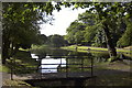
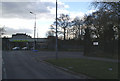
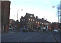
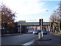
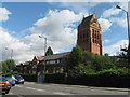
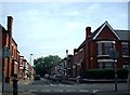
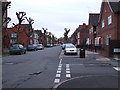
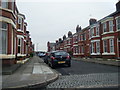
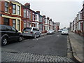
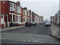
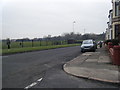
50 photos from this area
Area Information
Key information about the L15 3JH including its size, population, and administrative classification.
- Area Type
- Postcode
- Area Size
- 1.1 hectares
- Population
- 1587
- Population Density
- 5650 people/km²
House Prices in L15 3JH
57
Properties
£148,222
Average Sold Price
£18,500
Lowest Price
£440,000
Highest Price
Showing 57 properties
| Address | Type | Beds | Baths | Last Sale Price | Last Sale Date | |
|---|---|---|---|---|---|---|
| 70 Garmoyle Road, Liverpool, L15 3JH | Terraced | 1 | 1 | £220,000 | Mar 2025 | |
| 59 Garmoyle Road, Liverpool, L15 3JH | Terraced | 6 | 2 | £220,000 | Jul 2023 | |
| 95 Garmoyle Road, Liverpool, L15 3JH | Terraced | 8 | 5 | £440,000 | Mar 2022 | |
| 78 Garmoyle Road, Liverpool, L15 3JH | Terraced | 6 | 3 | £385,000 | Nov 2021 | |
| 99 Garmoyle Road, Liverpool, L15 3JH | Terraced | 4 | 3 | £224,000 | Aug 2021 | |
| 74 Garmoyle Road, Liverpool, L15 3JH | house | - | - | £180,000 | Aug 2021 | |
| 66 Garmoyle Road, Liverpool, L15 3JH | Terraced | 4 | 2 | £220,000 | Jun 2021 | |
| 79 Garmoyle Road, Liverpool, L15 3JH | house | 7 | 2 | £305,000 | Dec 2019 | |
| 60 Garmoyle Road, Liverpool, L15 3JH | Terraced | 6 | - | £130,000 | Sep 2018 | |
| 73 Garmoyle Road, Liverpool, L15 3JH | Terraced | 7 | 3 | £300,000 | Aug 2018 |
Page 1 of 6
Energy Efficiency in L15 3JH
Amenities
Schools
| Rank | School | Type | Entry gender | Ages |
|---|
Explore more schools in this area
Go to Schools tabDemographics
Household Size
Family (3-5 people)
most common
Accommodation Type
Houses
most common
Tenure
48
majority
Ethnic Group
White
most common
Religion
N/A
most common
Household Composition
N/A
most common
Age
22
median
Young Adults (15-29 years)
most common
Household Deprivation
N/A
with no deprivation
NS-SEC
17
in Lower managerial occupations
Explore more demographic insights in this area
Go to Demographics tabPlanning
Planning Constraints
- Flood RiskPremium
- Ramsar Wetland SitesPremium
- Area of Outstanding Natural BeautyPremium
- Protected Nature ReservePremium
- Protected WoodlandPremium