Area Overview for L10 9LT
Photos of L10 9LT

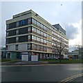


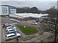
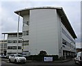
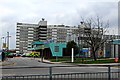

25 photos from this area
Area Information
Key information about the L10 9LT including its size, population, and administrative classification.
- Area Type
- Postcode
- Area Size
- 8720 m²
- Population
- 1388
- Population Density
- 1416 people/km²
House Prices in L10 9LT
35
Properties
£81,916
Average Sold Price
£13,600
Lowest Price
£184,000
Highest Price
Showing 35 properties
| Address | Type | Beds | Baths | Last Sale Price | Last Sale Date | |
|---|---|---|---|---|---|---|
| 52 Delagoa Road, Liverpool, L10 9LT | Terraced | 4 | 2 | £184,000 | Jun 2025 | |
| 26 Delagoa Road, Liverpool, L10 9LT | Terraced | 3 | 1 | £155,000 | Mar 2025 | |
| 32 Delagoa Road, Liverpool, L10 9LT | Terraced | 3 | - | £72,000 | Dec 2016 | |
| 20 Delagoa Road, Liverpool, L10 9LT | house | - | - | £77,000 | Apr 2016 | |
| 6 Delagoa Road, Liverpool, L10 9LT | house | - | - | £70,000 | Sep 2015 | |
| 58 Delagoa Road, Liverpool, L10 9LT | Terraced | 2 | 1 | £55,000 | Jan 2015 | |
| 42 Delagoa Road, Liverpool, L10 9LT | Semi-detached | 3 | 2 | £100,000 | Jun 2014 | |
| 2A Delagoa Road, Liverpool, L10 9LT | house | 3 | 1 | £74,000 | Apr 2014 | |
| 24 Delagoa Road, Liverpool, L10 9LT | Terraced | 2 | 1 | £62,500 | Aug 2012 | |
| 66 Delagoa Road, Liverpool, L10 9LT | Semi-detached | - | - | £112,500 | Sep 2005 |
Page 1 of 4
Energy Efficiency in L10 9LT
Amenities
Schools
| Rank | School | Type | Entry gender | Ages |
|---|
Explore more schools in this area
Go to Schools tabDemographics
Household Size
One person
most common
Accommodation Type
Houses
most common
Tenure
48
majority
Ethnic Group
White
most common
Religion
N/A
most common
Household Composition
N/A
most common
Age
47
median
Adults (30-64 years)
most common
Household Deprivation
N/A
with no deprivation
NS-SEC
19
in Lower managerial occupations
Explore more demographic insights in this area
Go to Demographics tabPlanning
Planning Constraints
- Flood RiskPremium
- Ramsar Wetland SitesPremium
- Area of Outstanding Natural BeautyPremium
- Protected Nature ReservePremium
- Protected WoodlandPremium