Area Overview for L10 2LB
Photos of L10 2LB
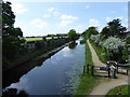
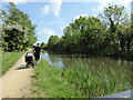
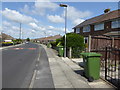
39 photos from this area
Area Information
Key information about the L10 2LB including its size, population, and administrative classification.
- Area Type
- Postcode
- Area Size
- 7136 m²
- Population
- 1360
- Population Density
- 4242 people/km²
House Prices in L10 2LB
18
Properties
£168,682
Average Sold Price
£50,000
Lowest Price
£240,000
Highest Price
Showing 18 properties
| Address | Type | Beds | Baths | Last Sale Price | Last Sale Date | |
|---|---|---|---|---|---|---|
| 10 Cranwell Close, Aintree, L10 2LB | Bungalow | 2 | - | £240,000 | May 2025 | |
| 16 Cranwell Close, Aintree, L10 2LB | Semi-detached | 2 | 1 | £227,000 | Feb 2024 | |
| 15 Cranwell Close, Aintree, L10 2LB | Bungalow | - | - | £140,000 | Feb 2023 | |
| 4 Cranwell Close, Aintree, L10 2LB | Bungalow | 2 | 1 | £212,500 | Jun 2021 | |
| 6 Cranwell Close, Aintree, L10 2LB | house | - | - | £200,000 | Jun 2020 | |
| 1 Cranwell Close, Aintree, L10 2LB | Bungalow | 2 | 1 | £155,000 | Dec 2018 | |
| 13 Cranwell Close, Aintree, L10 2LB | Bungalow | - | - | £195,000 | Aug 2018 | |
| 11 Cranwell Close, Aintree, L10 2LB | Bungalow | - | - | £168,000 | Oct 2010 | |
| 7 Cranwell Close, Aintree, L10 2LB | Semi-detached | - | - | £100,000 | Jun 2009 | |
| 9 Cranwell Close, Aintree, L10 2LB | Semi-detached | - | - | £168,000 | Jan 2009 |
Page 1 of 2
Energy Efficiency in L10 2LB
Amenities
Schools
| Rank | School | Type | Entry gender | Ages |
|---|
Explore more schools in this area
Go to Schools tabDemographics
Household Size
Two person
most common
Accommodation Type
Houses
most common
Tenure
90
majority
Ethnic Group
White
most common
Religion
N/A
most common
Household Composition
N/A
most common
Age
47
median
Adults (30-64 years)
most common
Household Deprivation
N/A
with no deprivation
NS-SEC
31
in Lower managerial occupations
Explore more demographic insights in this area
Go to Demographics tabPlanning
Planning Constraints
- Flood RiskPremium
- Ramsar Wetland SitesPremium
- Area of Outstanding Natural BeautyPremium
- Protected Nature ReservePremium
- Protected WoodlandPremium